Picture 1 of 1
Gallery
Picture 1 of 1

Have one to sell?
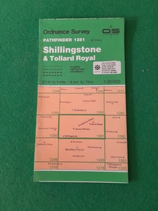
OS PATH FINDER SHEET 1281 SHILLINGSTONE & TOLLARD ROYAL MAP 1:25 000 SCALE

GBP 2.50
ApproximatelyRM 14.18
or Best Offer
Condition:
“VERY GOOD CLEAN MAP NO RIPS OR TEARS”
Very Good
A book that has been read but is in excellent condition. No obvious damage to the cover, with the dust jacket included for hard covers. No missing or damaged pages, no creases or tears, and no underlining/highlighting of text or writing in the margins. May be very minimal identifying marks on the inside cover. Very minimal wear and tear.
Oops! Looks like we're having trouble connecting to our server.
Refresh your browser window to try again.
Shipping:
GBP 13.83 (approx RM 78.47) International Priority Shipping to United States via eBay's Global Shipping Program.
Located in: Barnstaple, United Kingdom
Import charges:
Free amount confirmed at checkout
Delivery:
Estimated between Fri, 17 Oct and Mon, 27 Oct to 94104
Includes international tracking
Returns:
No returns accepted.
Coverage:
Read item description or contact seller for details. See all detailsSee all details on coverage
(Not eligible for eBay purchase protection programmes)
Seller assumes all responsibility for this listing.
eBay item number:406219018052
Item specifics
- Condition
- Very Good
- Seller Notes
- “VERY GOOD CLEAN MAP NO RIPS OR TEARS”
- Publication Name
- PATHFINDER
- Format & Map Type
- Ordnance Survey/Local Map
- Publisher
- Ordnance Survey
- Series
- PATHFINDER
- Publication Year
- 1987
- Type
- Hiking Map
- Format
- FOLDING PAPER
- Language
- English
- Country
- UK
- Region
- Great Britain
- Map Scale
- 1:25,000
- Country/Region of Manufacture
- United Kingdom
Item description from the seller

Seller feedback (5,256)
- eBay 自動留下信用評價- Feedback left by buyer.Past month訂單準時送達,沒遇到任何問題
- eBay 自動留下信用評價- Feedback left by buyer.Past month訂單準時送達,沒遇到任何問題
- eBay 自動留下信用評價- Feedback left by buyer.Past month訂單準時送達,沒遇到任何問題
This is a private listing and your identity will not be disclosed to anyone except the seller.
Seller feedback (5,256)
- eBay 自動留下信用評價- Feedback left by buyer.Past month訂單準時送達,沒遇到任何問題
- eBay 自動留下信用評價- Feedback left by buyer.Past month訂單準時送達,沒遇到任何問題
- eBay 自動留下信用評價- Feedback left by buyer.Past month訂單準時送達,沒遇到任何問題