Picture 1 of 3


Gallery
Picture 1 of 3


Have one to sell?
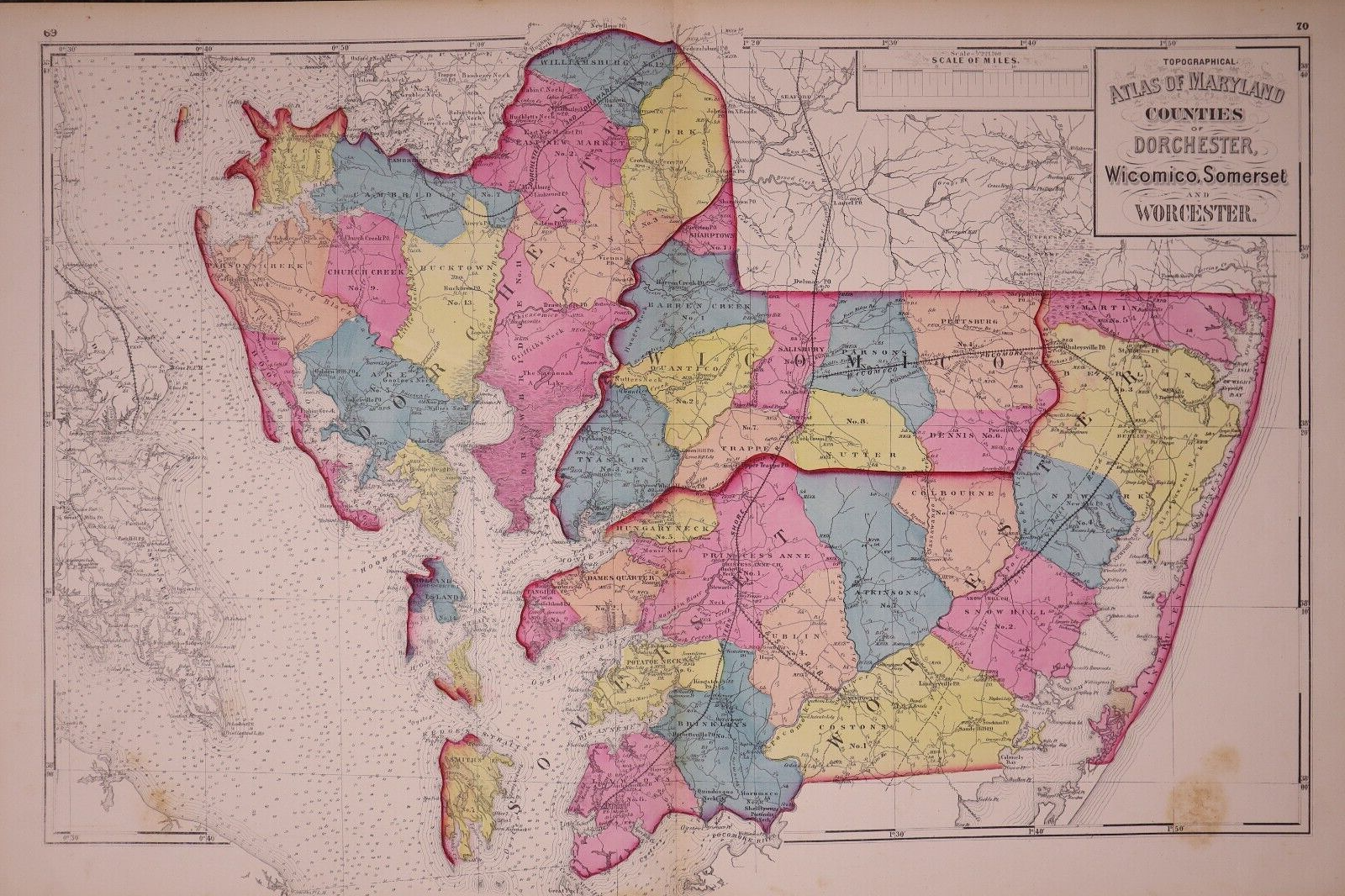
1873 County Map ~ DORCHESTER, WICOMICO, SOMERSET, WORCESTER, Co., MD (17x27)-#15

US $48.00
ApproximatelyRM 201.96
Condition:
“This map is not *new* or *new* condition. It was removed from a Maryland State Atlas and printed in ”... Read moreabout condition
Oops! Looks like we're having trouble connecting to our server.
Refresh your browser window to try again.
Shipping:
Free USPS Ground Advantage®.
Located in: Schertz, Texas, United States
Delivery:
Estimated between Thu, 4 Sep and Wed, 10 Sep
Returns:
30 days return. Buyer pays for return shipping. If you use an eBay shipping label, it will be deducted from your refund amount.
Coverage:
Read item description or contact seller for details. See all detailsSee all details on coverage
(Not eligible for eBay purchase protection programmes)
Seller assumes all responsibility for this listing.
eBay item number:406064129276
Item specifics
- Seller Notes
- US State
- Maryland
- Size
- Approx. 17" x 27"
- Cartographer/Publisher
- H. F. Walling, O. W. Gray & S. J. Martenet
- Publisher
- Published by Stedman, Brown & Lyon in 1873.
- Type
- County Map
- Format
- Atlas Map
- Year
- 1873
- S&H
- Free S&H USA - Calculated S&H Worldwide
- Original/Reproduction
- Antique Original
- Country/Region
- United States of America
- Original
- This map page was printed in 1873.
- Age
- Over 150 years old.
Item description from the seller

Seller feedback (9,723)
- 0***p (1711)- Feedback left by buyer.Past monthVerified purchaseSuper Nice map Fast Delivery Definitely AAA+ Thanks
- i***k (178)- Feedback left by buyer.Past monthVerified purchaseSeller has great customer service. Map was professionally packaged, and it arrived faster than estimated.
- m***n (829)- Feedback left by buyer.Past monthVerified purchaseThank you
More to explore :
Seller feedback (9,723)
- 0***p (1711)- Feedback left by buyer.Past monthVerified purchaseSuper Nice map Fast Delivery Definitely AAA+ Thanks
- i***k (178)- Feedback left by buyer.Past monthVerified purchaseSeller has great customer service. Map was professionally packaged, and it arrived faster than estimated.
- m***n (829)- Feedback left by buyer.Past monthVerified purchaseThank you