Picture 1 of 5


Gallery
Picture 1 of 5


Have one to sell?
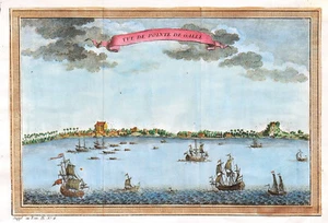
SRI LANKA "Vue de pointe de Galle" 1740-60 N. BELLIN ORIGINAL ANTIQUE MAP

US $60.00
ApproximatelyRM 253.11
Condition:
“Very Good”
Oops! Looks like we're having trouble connecting to our server.
Refresh your browser window to try again.
Returns:
14 days return. Buyer pays for return shipping. If you use an eBay shipping label, it will be deducted from your refund amount.
Coverage:
Read item description or contact seller for details. See all detailsSee all details on coverage
(Not eligible for eBay purchase protection programmes)
Seller assumes all responsibility for this listing.
eBay item number:405558605593
Item specifics
- Seller Notes
- “Very Good”
- Date Range
- 1700-1799
- Type
- Topographical Map
- Format
- Atlas Map
- Printing Technique
- Copper Plate
- Year
- 1740
- Original/Reproduction
- Antique Original
- Cartographer/Publisher
- Jacques Nicholas Bellin
- Country/Region
- India, Sri Lanka
Item description from the seller

Seller feedback (62)
- _***_ (421)- Feedback left by buyer.Past monthVerified purchaseLlegó en perfectas condiciones y a tiempo, la pieza es tal como la esperaba
- _***_ (421)- Feedback left by buyer.Past monthVerified purchaseLlegó en perfectas condiciones y a tiempo, la pieza es tal como la esperaba
- _***_ (421)- Feedback left by buyer.Past monthVerified purchaseLlegó en perfectas condiciones y a tiempo, la pieza es tal como la esperaba
More to explore :
- Sri Lanka Antique Original Antique Asia Maps & Atlases,
- Sri Lanka Antique Asia Folding Maps,
- Antique Asian Maps & Atlases Sri Lanka,
- Sri Lanka Copper Plate Antique Asia Maps & Atlases,
- Guillaume De L'Isle Antique Original Antique Maps, Atlases & Globes,
- Jacques Nicholas Bellin Antique County Maps,
- Antique Asian Maps & Sri Lanka 1600-1699 Date Range Atlases,
- Jacques Nicholas Bellin Copper Plate Antique Original Antique Maps, Atlases & Globes,
- Jacques Nicholas Bellin Antique Asia Atlas Maps,
- Guillaume De L'Isle Antique Maps, Atlases & Globes
Seller feedback (62)
- _***_ (421)- Feedback left by buyer.Past monthVerified purchaseLlegó en perfectas condiciones y a tiempo, la pieza es tal como la esperaba
- _***_ (421)- Feedback left by buyer.Past monthVerified purchaseLlegó en perfectas condiciones y a tiempo, la pieza es tal como la esperaba
- _***_ (421)- Feedback left by buyer.Past monthVerified purchaseLlegó en perfectas condiciones y a tiempo, la pieza es tal como la esperaba