Picture 1 of 2


Picture 1 of 2

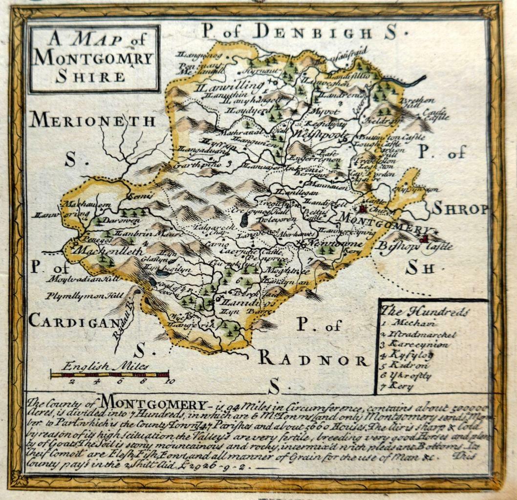
MONTGOMERYSHIR

GBP 34.99
ApproximatelyRM 194.32
Condition:
Postage:
GBP 8.00 (approx RM 44.43) Royal Mail International Tracked.
Located in: Poole, United Kingdom
Delivery:
Estimated between Thu, 3 Oct and Tue, 8 Oct to 43230
Returns:
30 days return. Buyer pays for return shipping.
Coverage:
Read item description or contact seller for details. See all detailsSee all details on coverage
(Not eligible for eBay purchase protection programmes)
Seller assumes all responsibility for this listing.
eBay item number:393910352673
Item specifics
- Type
- County Map
- Date Range
- 1700-1799
- Country/Region
- United Kingdom, Wales
- County
- Montgomeryshire
- Cartographer/Publisher
- Emanuel Bowen
- Printing Technique
- Copper Plate
- Original/Reproduction
- Antique Original
- Era
- 1700s
- Antique
- Yes
Item description from the seller

Popular categories from this store
Seller feedback (1,212)
- i***n (53)- Feedback left by buyer.Past monthVerified purchaseSpeedy delivery and excellent quality. Many thanks.
- i***n (53)- Feedback left by buyer.Past monthVerified purchaseSwift delivery, care taken packaging and excellent quality. Many thanks.
- i***l (14)- Feedback left by buyer.Past monthVerified purchaseThe item arrived as described and we'll packaged.
More to explore :
- Emanuel Bowen Antique Atlas Maps,
- Emanuel Bowen Antique Maps, Atlases & Globes,
- Emanuel Bowen Antique Europe Atlas Maps,
- Antique European Maps & Atlases Emanuel Bowen,
- Emanuel Bowen Copper Plate Antique Atlas Maps,
- Wales Antique Europe Maps & Atlases,
- Wales Antique Europe Railroad Maps,
- Wales Antique Europe Folding Maps,
- Antique European Maps & Atlases Wales Cornwall,
- London Wales Antique Europe Railroad Maps