Picture 1 of 1
Gallery
Picture 1 of 1

Have one to sell?
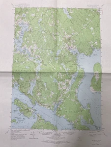
Map BLUE HILL Maine -1957 Topographic Geological N4415 W6830

US $9.99
ApproximatelyRM 42.05
Condition:
“Used - Has crease lines. Folded 2 times.”
Oops! Looks like we're having trouble connecting to our server.
Refresh your browser window to try again.
Shipping:
US $5.00 (approx RM 21.05) USPS Ground Advantage®.
Located in: Bowdoin, Maine, United States
Delivery:
Estimated between Thu, 9 Oct and Tue, 14 Oct to 94104
Returns:
30 days return. Buyer pays for return shipping. If you use an eBay shipping label, it will be deducted from your refund amount.
Coverage:
Read item description or contact seller for details. See all detailsSee all details on coverage
(Not eligible for eBay purchase protection programmes)
Shop with confidence
Seller assumes all responsibility for this listing.
eBay item number:388748952509
Item specifics
- Seller Notes
- “Used - Has crease lines. Folded 2 times.”
- US State
- Maine
- Printing Technique
- Lithography
- Cartographer/Publisher
- USGS
- City
- Blue Hill
- California Prop 65 Warning
- NA
- Date Range
- 1950-1959
- Type
- Topographical Map
- Format
- Sheet Map
- Mexican State
- NA
- Canadian Province
- NA
- Year
- 1957
- Original/Reproduction
- Antique Original
- Country/Region
- United States of America
Item description from the seller

Seller feedback (755)
- eBay 自動留下信用評價- Feedback left by buyer.Past month訂單準時送達,沒遇到任何問題
- eBay 自動留下信用評價- Feedback left by buyer.Past month訂單準時送達,沒遇到任何問題
- eBay 自動留下信用評價- Feedback left by buyer.Past month訂單準時送達,沒遇到任何問題
More to explore :
- Maine Antique North America Geological Maps,
- Maine Antique North America Topographical Maps,
- Maine Topographical Map Antique North America Sheet Maps,
- Antique Geological Maps,
- Geological Map Antique Wall Maps,
- Maine Antique Original Antique North America Topographical Maps,
- Antique World Geological Maps,
- Antique North America Geological Maps,
- Lithography Geological Map Antique Folding Maps,
- Geological Map Antique North America Folding Maps
Seller feedback (755)
- eBay 自動留下信用評價- Feedback left by buyer.Past month訂單準時送達,沒遇到任何問題
- eBay 自動留下信用評價- Feedback left by buyer.Past month訂單準時送達,沒遇到任何問題
- eBay 自動留下信用評價- Feedback left by buyer.Past month訂單準時送達,沒遇到任何問題