Picture 1 of 12


Gallery
Picture 1 of 12


Have one to sell?
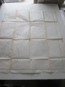
(1) 1856 U. S. COAST SURVEY CHART: "SKETCH A, SECTION No.1" TRIANGULATION ME-MA
US $50.00
ApproximatelyRM 210.45
or Best Offer
Condition:
Oops! Looks like we're having trouble connecting to our server.
Refresh your browser window to try again.
Shipping:
US $9.00 (approx RM 37.88) USPS Priority Mail®.
Located in: Rockport, Maine, United States
Delivery:
Estimated between Sat, 18 Oct and Sat, 25 Oct to 94104
Returns:
No returns accepted.
Coverage:
Read item description or contact seller for details. See all detailsSee all details on coverage
(Not eligible for eBay purchase protection programmes)
Seller assumes all responsibility for this listing.
eBay item number:382766165544
Item specifics
- Year
- 1853
- Special Attributes
- 1st Edition
- Country Of Manufacture
- United States
Item description from the seller
Popular categories from this store
Seller feedback (8,071)
- Évaluations automatiques eBay- Feedback left by buyer.Past monthCommande livrée dans les délais et sans problème
- Évaluations automatiques eBay- Feedback left by buyer.Past monthCommande livrée dans les délais et sans problème
- Évaluations automatiques eBay- Feedback left by buyer.Past monthCommande livrée dans les délais et sans problème
More to explore :
- US Coast Guard Antique Maritime Navigational Charts,
- Antique Ordnance Survey Maps,
- Antique Europe Ordnance Survey Maps,
- Vintage Original Antique Ordnance Survey Maps,
- Antique Original Antique Ordnance Survey Maps,
- Antique Original Antique Europe Ordnance Survey Maps,
- Antique Maritime Navigational Charts,
- WWII Antique Maritime Navigational Charts,
- Australia Antique Maritime Navigational Charts,
- CT, MA, ME, NH, RI, VT Antique Original Antique North America Atlas