Picture 1 of 8


Gallery
Picture 1 of 8


Have one to sell?
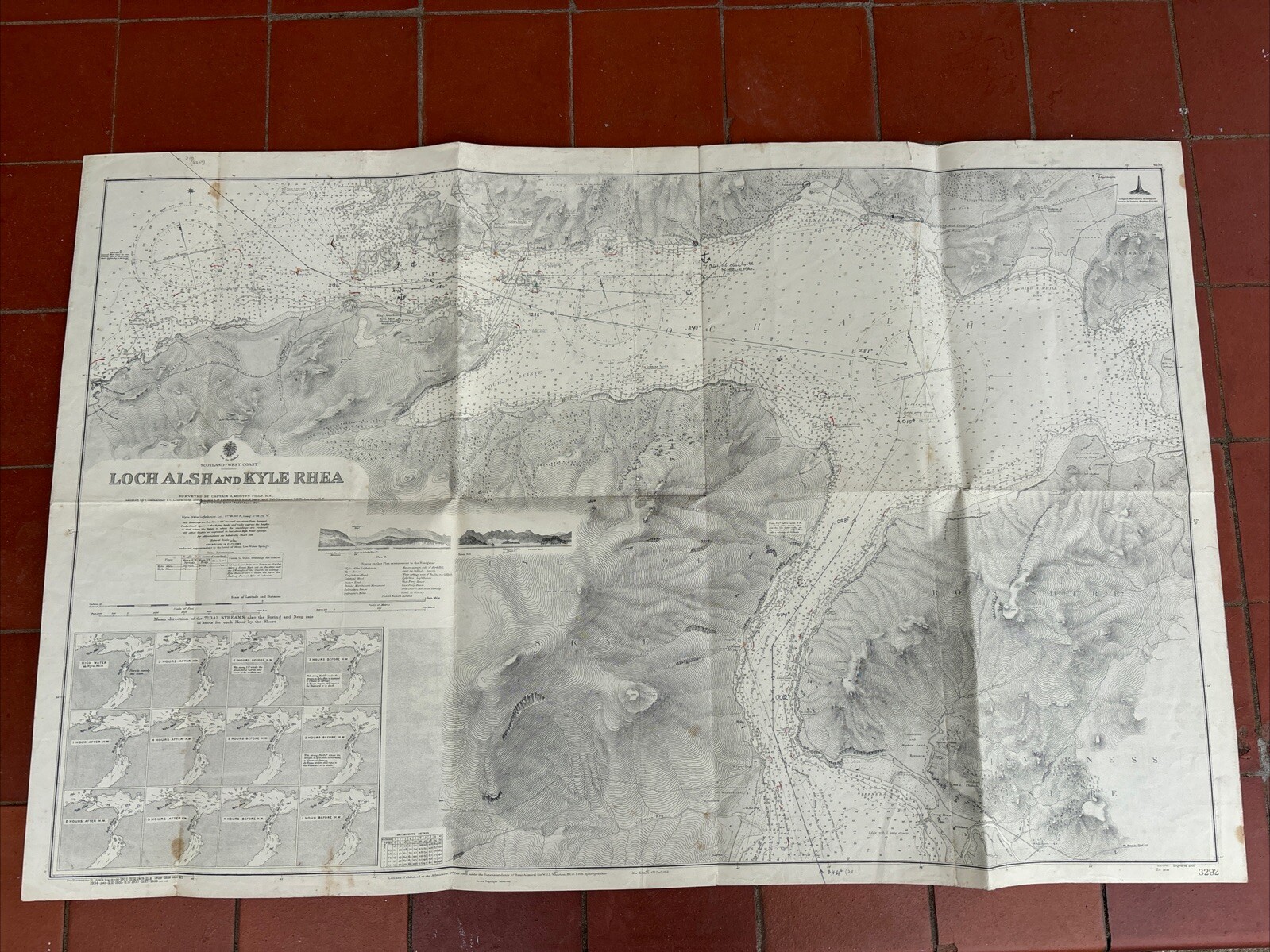
ADMIRALTY MAP SEA CHART HYDROGRAPHY - Loch Alsh & Kyle Rhea 3292

GBP 9.99
ApproximatelyRM 55.63
or Best Offer
Condition:
“used condition. Most maps are marked up with hazards, some are marked with bearings and related ”... Read moreabout condition
Oops! Looks like we're having trouble connecting to our server.
Refresh your browser window to try again.
Shipping:
Located in: Perth, United Kingdom
Delivery:
Varies
Returns:
No returns accepted.
Coverage:
Read item description or contact seller for details. See all detailsSee all details on coverage
(Not eligible for eBay purchase protection programmes)
Seller assumes all responsibility for this listing.
eBay item number:376165733975
Item specifics
- Seller Notes
- Date Range
- 1930-1939
- Antique
- Yes
- Type
- Nautical Map
- Year
- 1939
- Cartographer/Publisher
- The Admiralty
- Original/Reproduction
- Vintage Original
- Country/Region
- United Kingdom
Item description from the seller

Popular categories from this store
Seller feedback (1,269)
- y***e (1083)- Feedback left by buyer.Past 6 monthsVerified purchaseExcellent seller, items exactly as described, great communication, very helpful, so well packaged, great value postage. Highly recommended. One happy customer! 5⭐️Mottled Pink Art Glass Frill Top Bud Vase (#376209268778)
- 0***l (561)- Feedback left by buyer.Past monthVerified purchaseExcellent Ebayer, would recommend. Item exactly as described. Very well packaged, promptly posted and very good communication. Thank you 😊.
- m***m (1917)- Feedback left by buyer.Past 6 monthsVerified purchaseItem as described. The top of the packaging arrived slightly opened due to taping becoming unstuck on the box.
More to explore :
- Antique Maritime Navigational Charts,
- WWII Antique Maritime Navigational Charts,
- Australia Antique Maritime Navigational Charts,
- WWI Antique Maritime Navigational Charts,
- Canada Antique Maritime Navigational Charts,
- Political Map Antique Atlas Maps,
- County Map Antique Sheet Maps,
- Topographical Map Antique Wall Maps,
- Topographical Map Antique Folding Maps,
- Vintage Original Antique Maritime Navigational Charts
Popular categories from this store
Seller feedback (1,269)
- y***e (1083)- Feedback left by buyer.Past 6 monthsVerified purchaseExcellent seller, items exactly as described, great communication, very helpful, so well packaged, great value postage. Highly recommended. One happy customer! 5⭐️Mottled Pink Art Glass Frill Top Bud Vase (#376209268778)
- 0***l (561)- Feedback left by buyer.Past monthVerified purchaseExcellent Ebayer, would recommend. Item exactly as described. Very well packaged, promptly posted and very good communication. Thank you 😊.
- m***m (1917)- Feedback left by buyer.Past 6 monthsVerified purchaseItem as described. The top of the packaging arrived slightly opened due to taping becoming unstuck on the box.