Picture 1 of 2


Gallery
Picture 1 of 2

Have one to sell?
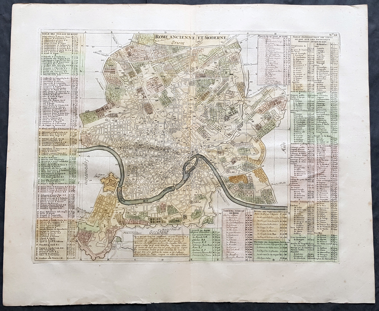
1719 Henri Chatelain Large Antique Map Plan of Rome, Italy

US $399.00
ApproximatelyRM 1,685.89
or Best Offer
Condition:
“Fine”
Oops! Looks like we're having trouble connecting to our server.
Refresh your browser window to try again.
Returns:
30 days return. Seller pays for return shipping.
Coverage:
Read item description or contact seller for details. See all detailsSee all details on coverage
(Not eligible for eBay purchase protection programmes)
Seller assumes all responsibility for this listing.
eBay item number:374571793390
Item specifics
- Seller Notes
- “Fine”
- Date Range
- 1700-1799
- Type
- City Map
- Printing Technique
- Copper Plate
- Format
- Atlas Map
- Year
- 1719
- Original/Reproduction
- Antique Original
- Cartographer/Publisher
- Chatelain
- City
- Rome
- Country/Region
- Italy
Item description from the seller
Seller business information
VAT number: AU 54097057022

Seller feedback (6,602)
- s***l (76)- Feedback left by buyer.Past monthVerified purchaseItem as described, packaged well, shipped quickly
- r***l (359)- Feedback left by buyer.Past monthVerified purchaseWell protected package Recommended trader Thank you
- 9***k (1314)- Feedback left by buyer.Past monthVerified purchaseWell-packaged fragile items shipped quickly. The transaction couldn’t have been easier. This seller is fantastic!
More to explore :
- Rome Italy Antique Europe Atlas Maps,
- Rome Italy Antique Europe City Maps,
- Antique European Maps & Atlases Rome Italy,
- Rome Italy Antique Original Antique European Maps & Atlases,
- Rome Italy Lithography Antique Europe Maps & Atlases,
- Antique European Maps & Atlases Italy,
- Chatelaine Silver Antiques,
- Italy Antique Europe City Maps,
- Italy Antique Europe River Maps,
- Italy Antique Europe County Maps
Seller feedback (6,602)
- s***l (76)- Feedback left by buyer.Past monthVerified purchaseItem as described, packaged well, shipped quickly
- r***l (359)- Feedback left by buyer.Past monthVerified purchaseWell protected package Recommended trader Thank you
- 9***k (1314)- Feedback left by buyer.Past monthVerified purchaseWell-packaged fragile items shipped quickly. The transaction couldn’t have been easier. This seller is fantastic!