Picture 1 of 3

Gallery
Picture 1 of 3


Have one to sell?
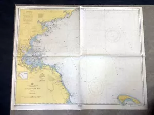
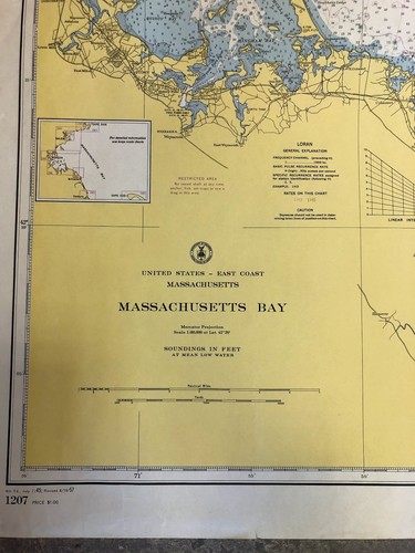
VINTAGE 1950s Nautical Chart Mass MASSACHUSETTS BAY Sailing NOAA

US $70.00
ApproximatelyRM 287.85
Condition:
Oops! Looks like we're having trouble connecting to our server.
Refresh your browser window to try again.
Shipping:
US $13.24 (approx RM 54.45) UPS Ground.
Located in: Nobleboro, Maine, United States
Delivery:
Estimated between Thu, 11 Dec and Wed, 17 Dec to 94104
Returns:
30 days return. Buyer pays for return shipping. If you use an eBay shipping label, it will be deducted from your refund amount.
Coverage:
Read item description or contact seller for details. See all detailsSee all details on coverage
(Not eligible for eBay purchase protection programmes)
About this item
Seller assumes all responsibility for this listing.
eBay item number:372401463246
Item specifics
- Features
- Vintage
- Maker
- UNITED STATES COAST & GEODETIC SURVEY
- Format
- Nautical Map
- Year
- 1950
- US State
- Massachusetts
- Publication Year
- 1950
- City
- Boston
- Country/Region
- United States of America
- Color
- Blue
- Genre
- Blues
- Date Range
- 1950-1959
- Type
- Map
- Original/Reproduction
- Original
Item description from the seller

Popular categories from this store
Seller feedback (9,704)
- b***1 (11)- Feedback left by buyer.Past 6 monthsVerified purchaseExactly as described, packaging was very good, value was great! Shopping, I received sooner than expected
- o***t (709)- Feedback left by buyer.Past 6 monthsVerified purchaseJust as described and pictured. Packed so well. No issues. Great communication with seller. So happy overall! 😊 Thank you!Lot of Lucite Bathroom Organizers - 9 Pieces (#326379501409)
- r***z (1050)- Feedback left by buyer.Past monthVerified purchaseItem was properly described. Item was packaged properly and arrived timely.
More to explore :
- Massachusetts Antique North America Nautical Maps,
- Massachusetts Antique Original Antique North America Nautical Maps,
- Massachusetts 1800-1899 Date Range Antique North America Nautical Maps,
- Vintage Reproduction 1950-1959 Date Range Antique Nautical Maps,
- Vintage Original Antique Maritime Navigational Charts,
- Massachusetts Antique North America Maps & Atlases 1950-1959 Date Range,
- 1950-1959 Date Range Antique Nautical Maps,
- Massachusetts Antique North America Railroad Maps,
- Massachusetts Antique North America County Maps,
- Vintage Original Antique North America Nautical Maps
Popular categories from this store
Seller feedback (9,704)
- b***1 (11)- Feedback left by buyer.Past 6 monthsVerified purchaseExactly as described, packaging was very good, value was great! Shopping, I received sooner than expected
- o***t (709)- Feedback left by buyer.Past 6 monthsVerified purchaseJust as described and pictured. Packed so well. No issues. Great communication with seller. So happy overall! 😊 Thank you!Lot of Lucite Bathroom Organizers - 9 Pieces (#326379501409)
- r***z (1050)- Feedback left by buyer.Past monthVerified purchaseItem was properly described. Item was packaged properly and arrived timely.