Philip's Street Atlas Worcestershire: Pocket Edition - Philip's Maps
GBP 4.99GBP 4.99
Jul 05, 00:25Jul 05, 00:25
Picture 1 of 1
Gallery
Picture 1 of 1
Have one to sell?
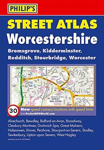
Philip's Street Atlas Worcestershire

GBP 4.99
ApproximatelyRM 28.17
Condition:
Like New
A book in excellent condition. Cover is shiny and undamaged, and the dust jacket is included for hard covers. No missing or damaged pages, no creases or tears, and no underlining/highlighting of text or writing in the margins. May be very minimal identifying marks on the inside cover. Very minimal wear and tear.
Oops! Looks like we're having trouble connecting to our server.
Refresh your browser window to try again.
Shipping:
GBP 5.00 (approx RM 28.23) Economy Int'l Postage.
Located in: Rossendale, United Kingdom
Delivery:
Estimated between Wed, 20 Aug and Fri, 5 Sep to 94104
Returns:
30 days return. Buyer pays for return shipping. If you use an eBay shipping label, it will be deducted from your refund amount.
Coverage:
Read item description or contact seller for details. See all detailsSee all details on coverage
(Not eligible for eBay purchase protection programmes)
Seller assumes all responsibility for this listing.
eBay item number:365578973058
Item specifics
- Condition
- Book Title
- Philip's Street Atlas Worcestershire: Pocket Edition
- Genre
- Travel maps & atlases
- ISBN
- 9780540092123
About this product
Product Information
This fully revised pocket-sized street atlas of Worcestershire gives comprehensive and detailed coverage of the county. The route planner shows all the A and B roads, and can be used when driving to get close to the destination before turning to the relevant large-scale street map.The street maps show every named road, street and lane very clearly, with major roads picked out in colour. The maps are at a standard scale of 2 2/3 inches to 1 mile, and show postcode boundaries. Other information on the maps includes car parks, railway and bus stations, post offices, schools, colleges, hospitals, police and fire stations, places of worship, leisure centres, footpaths and bridleways, camping and caravan sites, golf courses, and many other places of interest. New to this edition are fixed single and multiple speed-camera locations, with corresponding speed limits.The comprehensive index lists street names and postcodes, plus schools, hospitals, railway stations, shopping centres and other such features picked out in red, with other places of interest shown in blue.
Product Identifiers
Publisher
Octopus
ISBN-13
9780540092123
eBay Product ID (ePID)
92343782
Product Key Features
Number of Pages
240 Pages
Publication Name
Philip's Street Atlas Worcestershire
Language
English
Subject
Transportation
Publication Year
2009
Type
Travel Map
Format
Paperback
Dimensions
Item Height
206 mm
Item Weight
366 g
Item Width
143 mm
Additional Product Features
Country/Region of Manufacture
United Kingdom
Series Title
Philip's Street Atlases
Item description from the seller
Seller business information
VAT number: GB 901578627

Seller feedback (3,091,943)
This item (1)
All items (3,091,943)
- Automatische Bewertung von eBay- Feedback left by buyer.Past monthBestellung erfolgreich durchgeführt - mit Sendungsverfolgung und fristgerecht
- Automatische Bewertung von eBay- Feedback left by buyer.Past monthBestellung erfolgreich durchgeführt - mit Sendungsverfolgung und fristgerecht
- Automatische Bewertung von eBay- Feedback left by buyer.Past monthBestellung erfolgreich durchgeführt - mit Sendungsverfolgung und fristgerecht
More to explore :
- Atlas 1st Edition,
- Atlas Revised Edition,
- Philip Pullman First Edition Antiquarian & Collectible Books,
- Philip Pullman Limited Edition Antiquarian & Collectible Books,
- Atlas Paperback Maps & Atlases in English,
- Fiction & Philip K. Dick Books,
- Philip Pullman Fiction & Books,
- Philip K. Dick 1st Edition Science Fiction Antiquarian & Collectible Books,
- Philip Pullman Paperbacks Books,
- Atlas
Seller feedback (3,091,943)
This item (1)
All items (3,091,943)
- Automatische Bewertung von eBay- Feedback left by buyer.Past monthBestellung erfolgreich durchgeführt - mit Sendungsverfolgung und fristgerecht
- Automatische Bewertung von eBay- Feedback left by buyer.Past monthBestellung erfolgreich durchgeführt - mit Sendungsverfolgung und fristgerecht
- Automatische Bewertung von eBay- Feedback left by buyer.Past monthBestellung erfolgreich durchgeführt - mit Sendungsverfolgung und fristgerecht