Picture 1 of 3


Gallery
Picture 1 of 3


Have one to sell?
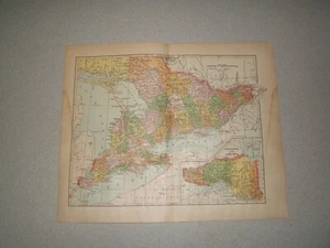
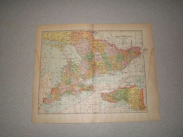
Map of Ontario Railroads & Towns & Canals Color Plate circa 1900

US $12.99
ApproximatelyRM 54.93
Condition:
Oops! Looks like we're having trouble connecting to our server.
Refresh your browser window to try again.
Shipping:
Free USPS Priority Mail®.
Located in: Newport, Pennsylvania, United States
Delivery:
Estimated between Tue, 9 Sep and Mon, 15 Sep to 94104
Returns:
30 days return. Seller pays for return shipping.
Coverage:
Read item description or contact seller for details. See all detailsSee all details on coverage
(Not eligible for eBay purchase protection programmes)
Seller assumes all responsibility for this listing.
eBay item number:362826217083
Item specifics
- Date Range
- 1900-1909
- Country/Region
- Canada
- Type
- County Map
- Canadian Province
- Ontario
- Format
- Sheet Map
- MPN
- Does not apply
Item description from the seller

Seller feedback (38,482)
- Évaluations automatiques eBay- Feedback left by buyer.Past monthCommande terminée - avec suivi et dans les délais
- p***p (108)- Feedback left by buyer.Past monthVerified purchaseVery happy with my purchase
- 6***_ (7)- Feedback left by buyer.Past monthVerified purchaseItems well packaged and as described. Would purchase from this vendor again.
More to explore :
- Ontario Antique North America Railroad Maps,
- Copper Plate Railroad Map Antique Atlas Maps,
- Ontario Copper Plate Antique North America Maps & Atlases,
- Copper Plate Antique Railroad Maps,
- Antique North American Maps Ontario 1900-1909 Date Range Atlases,
- 1900-1909 Date Range Railroad Map Antique North America Folding Maps,
- Antique Original 1900-1909 Date Range Antique Railroad Maps,
- Antique Railroad Maps,
- Railroad Map Antique Folding Maps,
- Railroad Map Antique Wall Maps
Seller feedback (38,482)
- Évaluations automatiques eBay- Feedback left by buyer.Past monthCommande terminée - avec suivi et dans les délais
- p***p (108)- Feedback left by buyer.Past monthVerified purchaseVery happy with my purchase
- 6***_ (7)- Feedback left by buyer.Past monthVerified purchaseItems well packaged and as described. Would purchase from this vendor again.