Picture 1 of 14


Gallery
Picture 1 of 14


Have one to sell?
4 Mitchell Maps of 1870 Midwest-1.OH,K

US $44.95
ApproximatelyRM 190.81
or Best Offer
Condition:
“good-very sharp, bright and clean-double sided double folded”
Oops! Looks like we're having trouble connecting to our server.
Refresh your browser window to try again.
Shipping:
US $8.75 (approx RM 37.14) USPS Ground Advantage®.
Located in: Bar Harbor, Maine, United States
Delivery:
Estimated between Wed, 13 Aug and Tue, 19 Aug to 94104
Returns:
No returns accepted.
Coverage:
Read item description or contact seller for details. See all detailsSee all details on coverage
(Not eligible for eBay purchase protection programmes)
Seller assumes all responsibility for this listing.
eBay item number:355943757258
Item specifics
- Seller Notes
- “good-very sharp, bright and clean-double sided double folded”
- Date Range
- 1870-1880
- Format
- Atlas Map
- Printing Technique
- Copper Plate
- US State
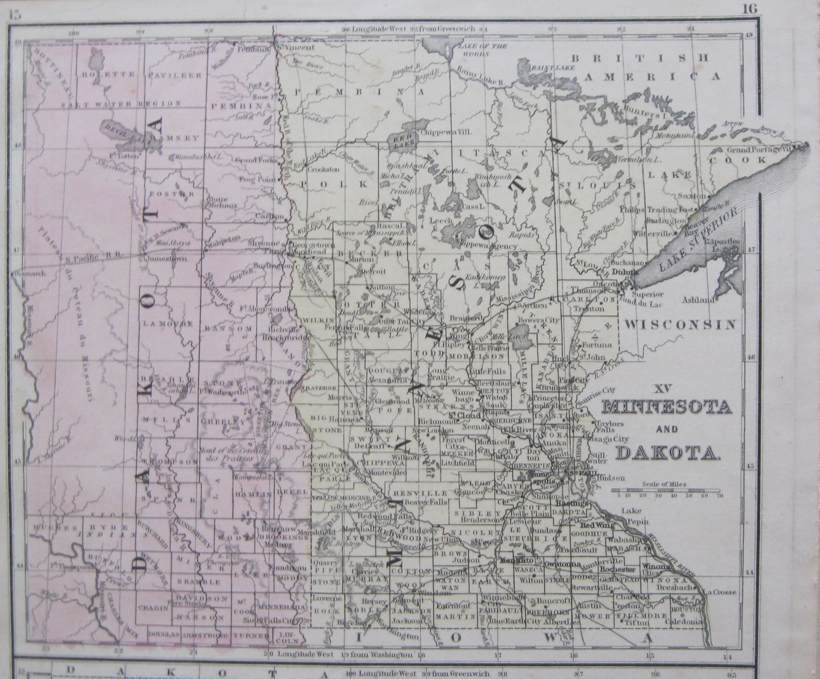
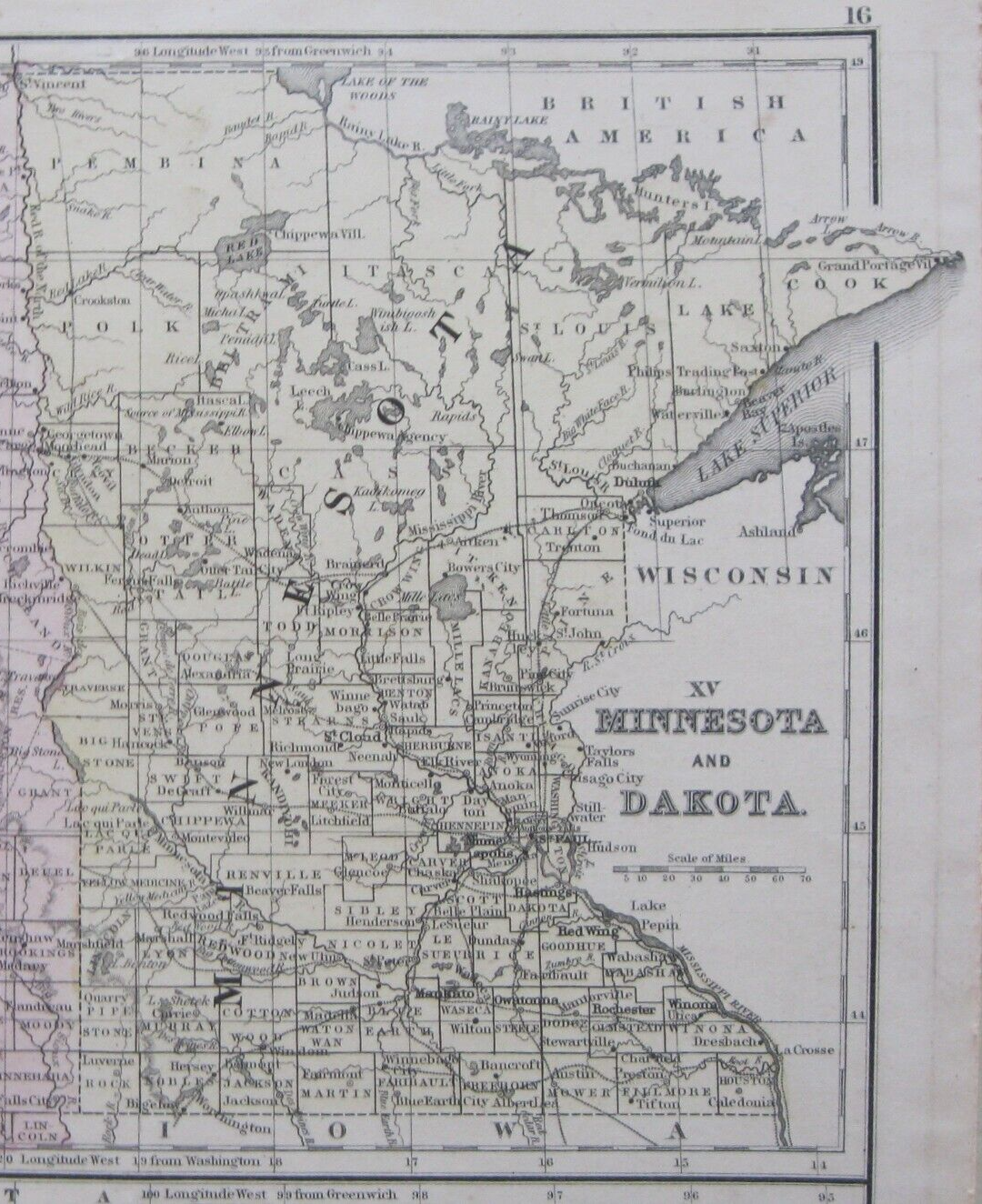
- Illinois, Indiana, Iowa, Kentucky, Michigan, Minnesota, Missouri, Nebraska, Ohio, Wisconsin
- Year
- 1870
- U.S. Territories
- Dakota
- Size
- 9.2" x 11.5
- Original/Reproduction
- Antique Original
- Cartographer/Publisher
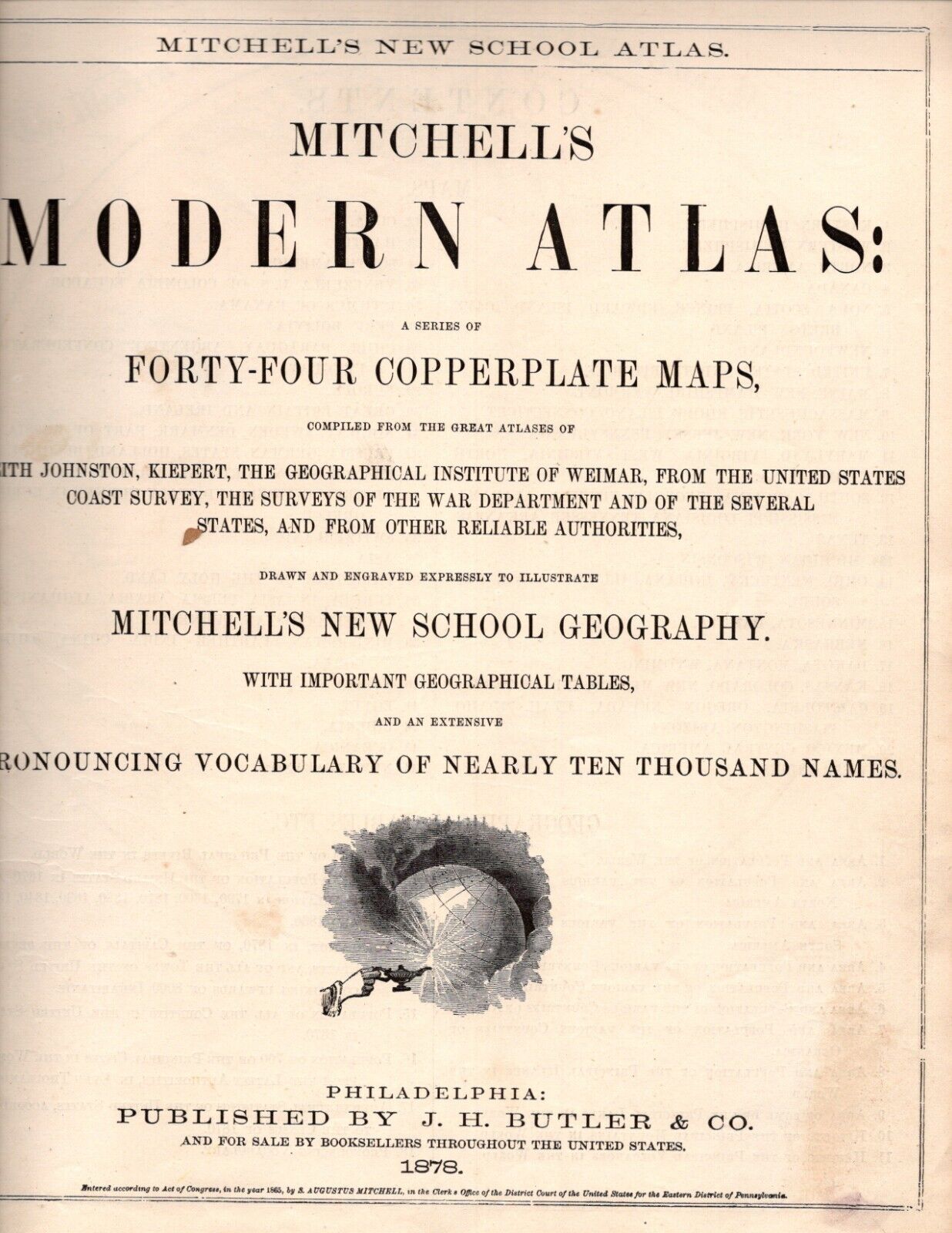
- Samuel Augustus Mitchell
- Publisher
- J. H. Butler & Co.
- Country/Region
- United States of America
Item description from the seller

Seller feedback (1,536)
- 1***v (401)- Feedback left by buyer.Past monthVerified purchaseExcellent!!
- n***n (1449)- Feedback left by buyer.Past monthVerified purchaseWonderful eBayer. Flag chart arrived in great shape. Thank you.
- n***n (1449)- Feedback left by buyer.Past monthVerified purchaseWonderful eBayer. Flags pages arrived in great shape. Thank you
More to explore :
- IL, IN, MI, OH, WI Antique North America Atlas Maps,
- IL, IN, MI, OH, WI Antique North America Wall Maps,
- IL, IN, MI, OH, WI Antique North America County Maps,
- IL, IN, MI, OH, WI Antique North American Maps & Atlases,
- IL, IN, MI, OH, WI Antique North America City Maps,
- IL, IN, MI, OH, WI County Map Antique North America Atlas Maps,
- Woodcut IL, IN, MI, OH, WI Antique North American Maps & Atlases,
- Woodcut IL, IN, MI, OH, WI Antique North America Wall Maps,
- Vintage Reproduction IL, IN, MI, OH, WI Antique North American Maps & Atlases,
- Alvin Jewett Johnson IL, IN, MI, OH, WI Antique North American Maps & Atlases
Seller feedback (1,536)
- 1***v (401)- Feedback left by buyer.Past monthVerified purchaseExcellent!!
- n***n (1449)- Feedback left by buyer.Past monthVerified purchaseWonderful eBayer. Flag chart arrived in great shape. Thank you.
- n***n (1449)- Feedback left by buyer.Past monthVerified purchaseWonderful eBayer. Flags pages arrived in great shape. Thank you