Picture 1 of 6


Gallery
Picture 1 of 6


Have one to sell?
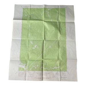
Merry Creek Quadrangle Idaho 1969 USGS Topographic Map 7.5 Minute Series

US $7.95
ApproximatelyRM 34.01
or Best Offer
Condition:
“Good condition. Fold lines, minor blemishes, marks, tape, small tears may be present. See photos.”
Oops! Looks like we're having trouble connecting to our server.
Refresh your browser window to try again.
Shipping:
US $7.85 (approx RM 33.58) USPS Ground Advantage®.
Located in: Richland, Washington, United States
Delivery:
Estimated between Wed, 6 Aug and Fri, 8 Aug to 94104
Returns:
30 days return. Seller pays for return shipping.
Coverage:
Read item description or contact seller for details. See all detailsSee all details on coverage
(Not eligible for eBay purchase protection programmes)
Seller assumes all responsibility for this listing.
eBay item number:355900785799
Item specifics
- Seller Notes
- “Good condition. Fold lines, minor blemishes, marks, tape, small tears may be present. See photos.”
- Format
- Folding Map
- Year
- 1969
- US State
- Idaho
- City
- Merry Creek Shoshone County
- Country/Region
- United States of America
- Cartographer/Publisher
- USGS
- Type
- Topographical Map
- Original/Reproduction
- Vintage Original
Item description from the seller

Popular categories from this store
Seller feedback (2,693)
- e***j (412)- Feedback left by buyer.Past monthVerified purchaseExcellent ebay transaction and item received
- k***_ (355)- Feedback left by buyer.Past monthVerified purchaseSuper fast shipping, item in perfect condition and carefully packaged. Great transaction.
- m***j (1098)- Feedback left by buyer.Past monthVerified purchasePerfect !!
More to explore :
- Idaho Antique North America Topographical Maps,
- Idaho Topographical Map Antique North America Folding Maps,
- 1960-1969 Date Range Antique Topographical Maps,
- 1960-1969 Date Range Sheet Map Topographical Map Antique Maps, Atlases & Globes,
- Antique Topographical Maps,
- Topographical Map Antique Wall Maps,
- Lithography Topographical Map Antique Folding Maps,
- 1960-1969 Date Range Antique North America Topographical Maps,
- Woodcut Topographical Map Antique Atlas Maps,
- Idaho Geological Map Antique North America Folding Maps
Popular categories from this store
Seller feedback (2,693)
- e***j (412)- Feedback left by buyer.Past monthVerified purchaseExcellent ebay transaction and item received
- k***_ (355)- Feedback left by buyer.Past monthVerified purchaseSuper fast shipping, item in perfect condition and carefully packaged. Great transaction.
- m***j (1098)- Feedback left by buyer.Past monthVerified purchasePerfect !!