Picture 1 of 7


Gallery
Picture 1 of 7
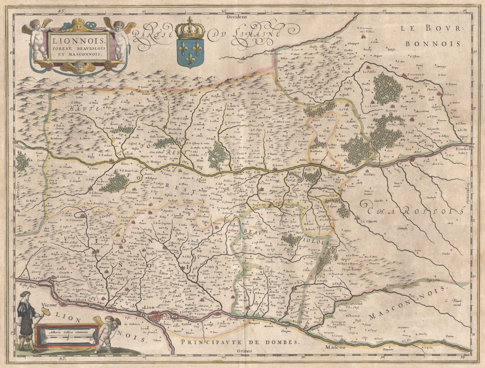

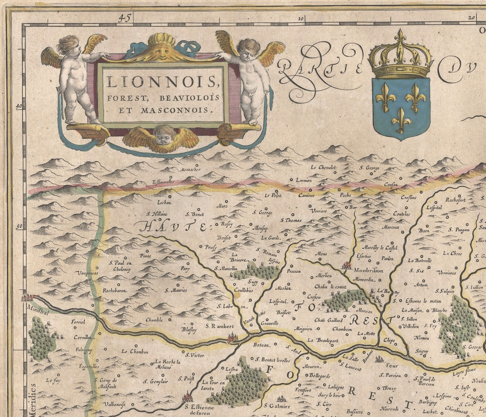
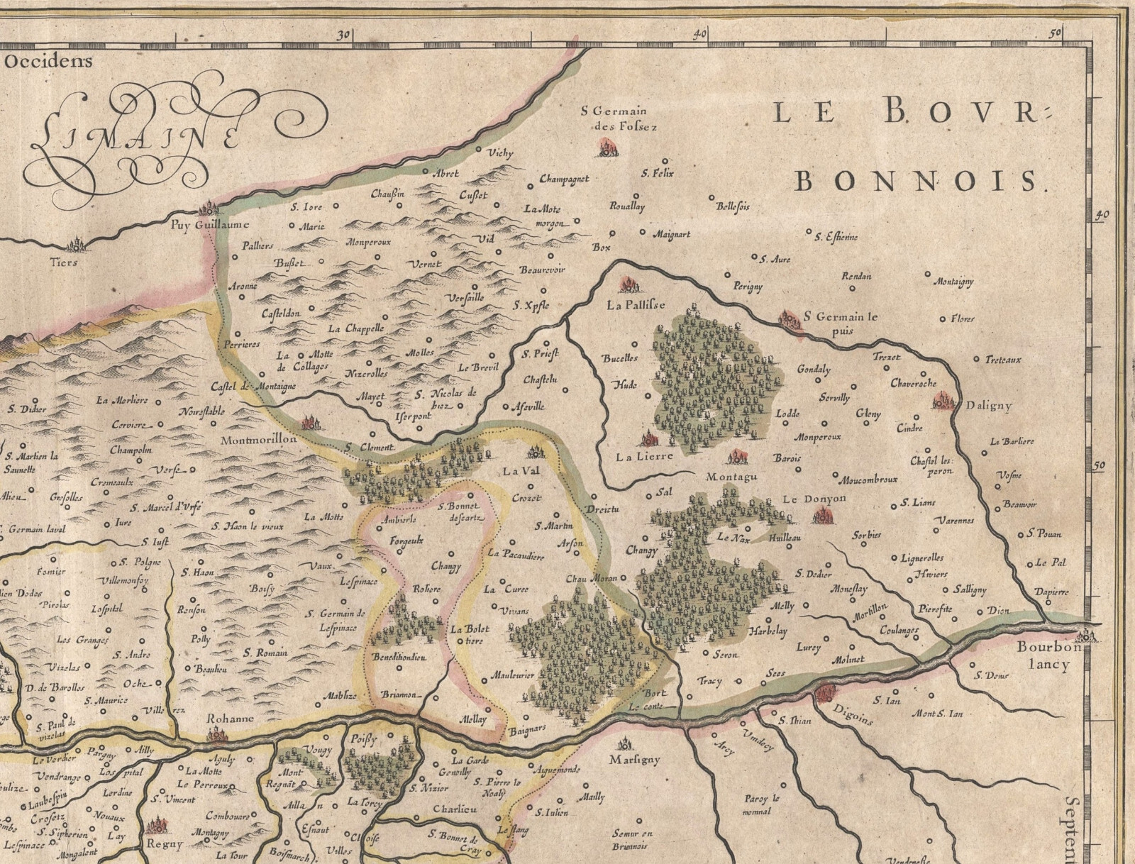
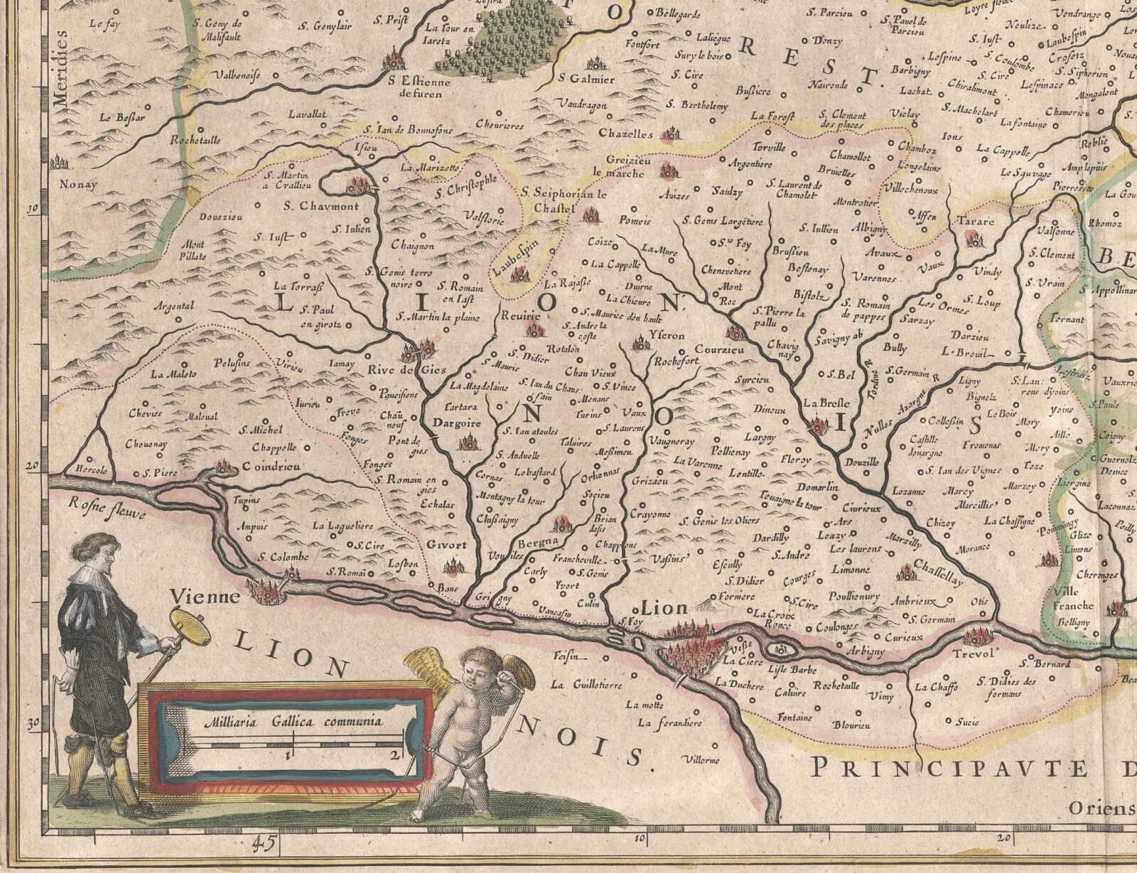
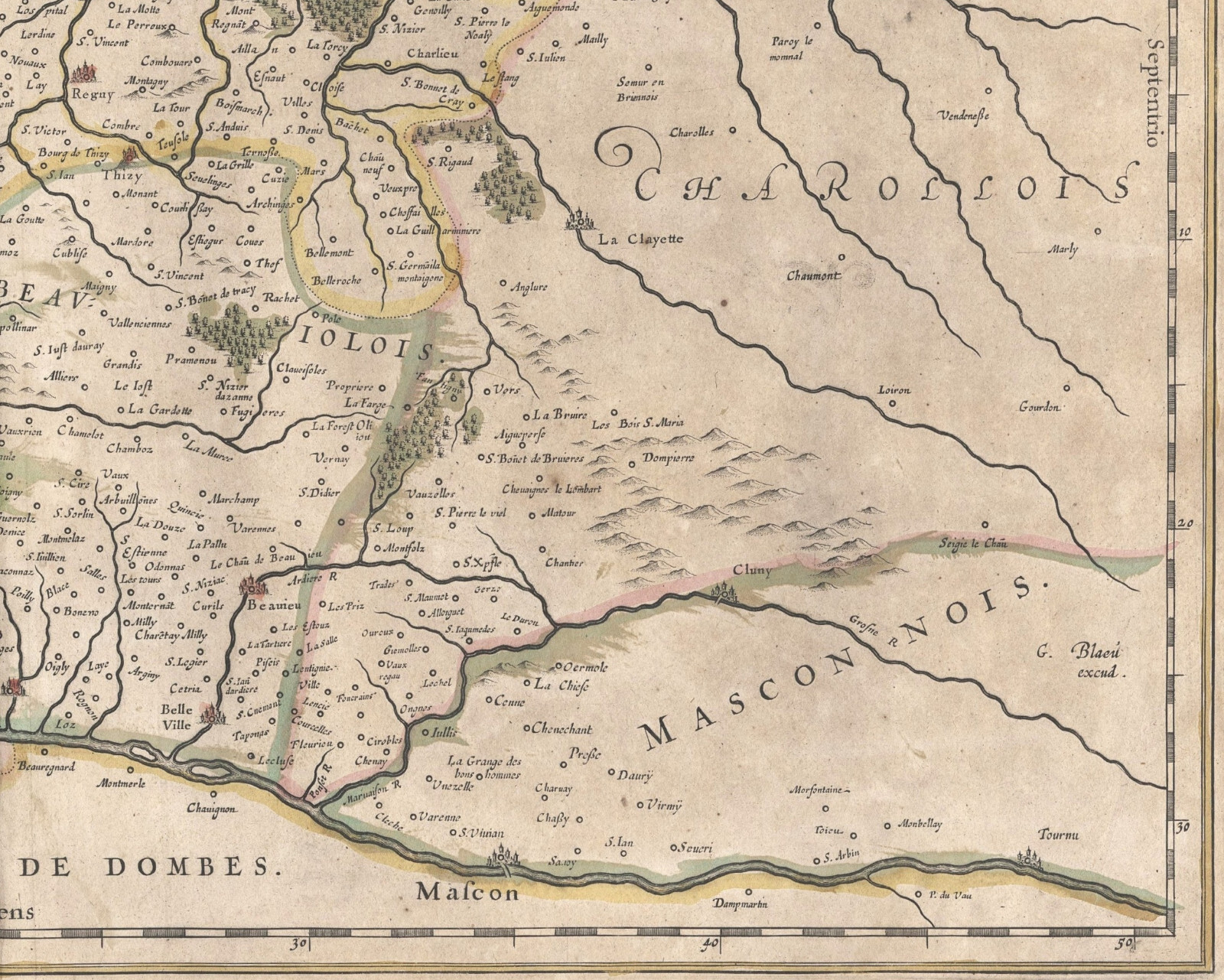
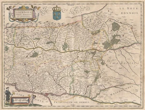
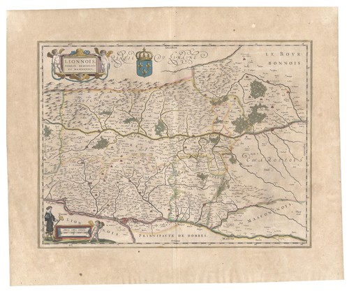
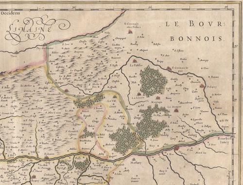
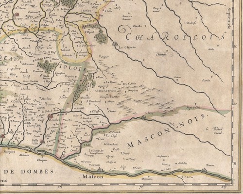
Map "Lionnois, Forest, Beaviolois et Masconnois" (Rhône-Loire Valley)Blaeu, 1645

GBP 260.00
ApproximatelyRM 1,487.56
or Best Offer
Condition:
Oops! Looks like we're having trouble connecting to our server.
Refresh your browser window to try again.
Shipping:
GBP 18.00 (approx RM 102.98) Royal Mail International Tracked.
Located in: London, United Kingdom
Delivery:
Estimated between Mon, 30 Jun and Tue, 8 Jul to 94104
Returns:
No returns accepted.
Coverage:
Read item description or contact seller for details. See all detailsSee all details on coverage
(Not eligible for eBay purchase protection programmes)
Seller assumes all responsibility for this listing.
eBay item number:335941821242
Item specifics
- Antique
- Yes
- Date Range
- 1600-1699
- Type
- County Map
- Format
- Sheet Map
- Printing Technique
- Copper Plate
- Year
- 1645
- Era
- 1600s
- Cartographer/Publisher
- Willem Janszoon Blaeu
- Original/Reproduction
- Antique Original
- City
- Lyon
- Country/Region
- France
- County
- Auvergne-Rhône-Alpes
Item description from the seller

Popular categories from this store
Seller feedback (291)
- l***e (228)- Feedback left by buyer.Past monthVerified purchaseVery interesting old print, excellent communication
- Automatische Bewertung von eBay- Feedback left by buyer.Past monthBestellung erfolgreich durchgeführt - mit Sendungsverfolgung und fristgerecht
- Automatische Bewertung von eBay- Feedback left by buyer.Past monthBestellung erfolgreich durchgeführt - mit Sendungsverfolgung und fristgerecht
More to explore :
- Willem Blaeu Antique County Maps,
- Willem Blaeu Antique Folding Maps,
- Antique European Maps & Atlases Willem Blaeu,
- Willem Blaeu Antique World Maps & Atlases,
- Willem Blaeu Antique Maps, Atlases & Globes,
- Willem Blaeu Copper Plate Antique World Folding Maps,
- Willem Blaeu Copper Plate Antique Maps, Atlases & Globes,
- Willem Blaeu Copper Plate Antique World Maps & Atlases,
- Willem Blaeu Copper Plate Antique World County Maps,
- Antique European Maps Willem Blaeu 1600-1699 Date Range Atlases
Popular categories from this store
Seller feedback (291)
- l***e (228)- Feedback left by buyer.Past monthVerified purchaseVery interesting old print, excellent communication
- Automatische Bewertung von eBay- Feedback left by buyer.Past monthBestellung erfolgreich durchgeführt - mit Sendungsverfolgung und fristgerecht
- Automatische Bewertung von eBay- Feedback left by buyer.Past monthBestellung erfolgreich durchgeführt - mit Sendungsverfolgung und fristgerecht