Picture 1 of 8


Gallery
Picture 1 of 8


Have one to sell?
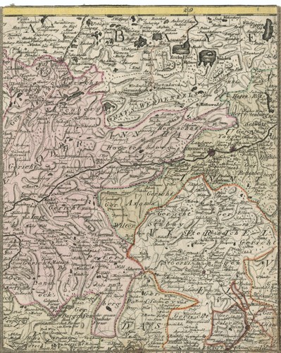
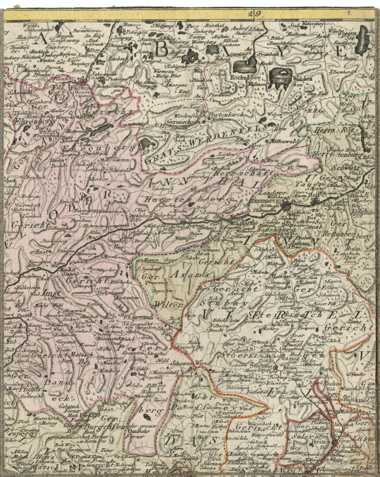
Antique Map "Karte von der gefürsteten Grafschaft Tyrol" (Austria) Walch, 1798

GBP 400.00
ApproximatelyRM 2,282.34
or Best Offer
Condition:
Oops! Looks like we're having trouble connecting to our server.
Refresh your browser window to try again.
Returns:
No returns accepted.
Coverage:
Read item description or contact seller for details. See all detailsSee all details on coverage
(Not eligible for eBay purchase protection programmes)
Seller assumes all responsibility for this listing.
eBay item number:335925179745
Item specifics
- Date Range
- 1700-1799
- Antique
- Yes
- Type
- County Map
- Format
- Folding Map
- Printing Technique
- Copper Plate
- Year
- 1798
- Era
- 1700s
- Cartographer/Publisher
- Johann Walch
- Original/Reproduction
- Antique Original
- Country/Region
- Austria, Italy, Switzerland
- County
- Tyrol
Item description from the seller

Popular categories from this store
Seller feedback (306)
- t***3 (481)- Feedback left by buyer.Past monthVerified purchaseThank you so much for getting this right out.
- 3***l (185)- Feedback left by buyer.Past monthVerified purchaseI have received this book and I really like it. Thank you to the seller for providing such a wonderful book!
- Automatische feedback van eBay- Feedback left by buyer.Past monthBestelling voltooid - getrackt en op tijd
More to explore :
- Austria Antique Europe Topographical Maps,
- Antique European Maps & Atlases Austria,
- Austria Antique Europe Folding Maps,
- Austria Antique Europe Political Maps,
- Austria Antique Europe Sheet Maps,
- Austria Antique Europe City Maps,
- Austria Topographical Map Antique Europe Atlas Maps,
- Austria Antique Original Antique Europe City Maps,
- Salzburg Austria Antique Original Antique European Maps & Atlases,
- Austria Copper Plate Antique Europe Folding Maps
Popular categories from this store
Seller feedback (306)
- t***3 (481)- Feedback left by buyer.Past monthVerified purchaseThank you so much for getting this right out.
- 3***l (185)- Feedback left by buyer.Past monthVerified purchaseI have received this book and I really like it. Thank you to the seller for providing such a wonderful book!
- Automatische feedback van eBay- Feedback left by buyer.Past monthBestelling voltooid - getrackt en op tijd