Picture 1 of 3


Gallery
Picture 1 of 3


Have one to sell?
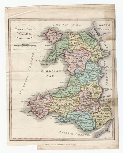
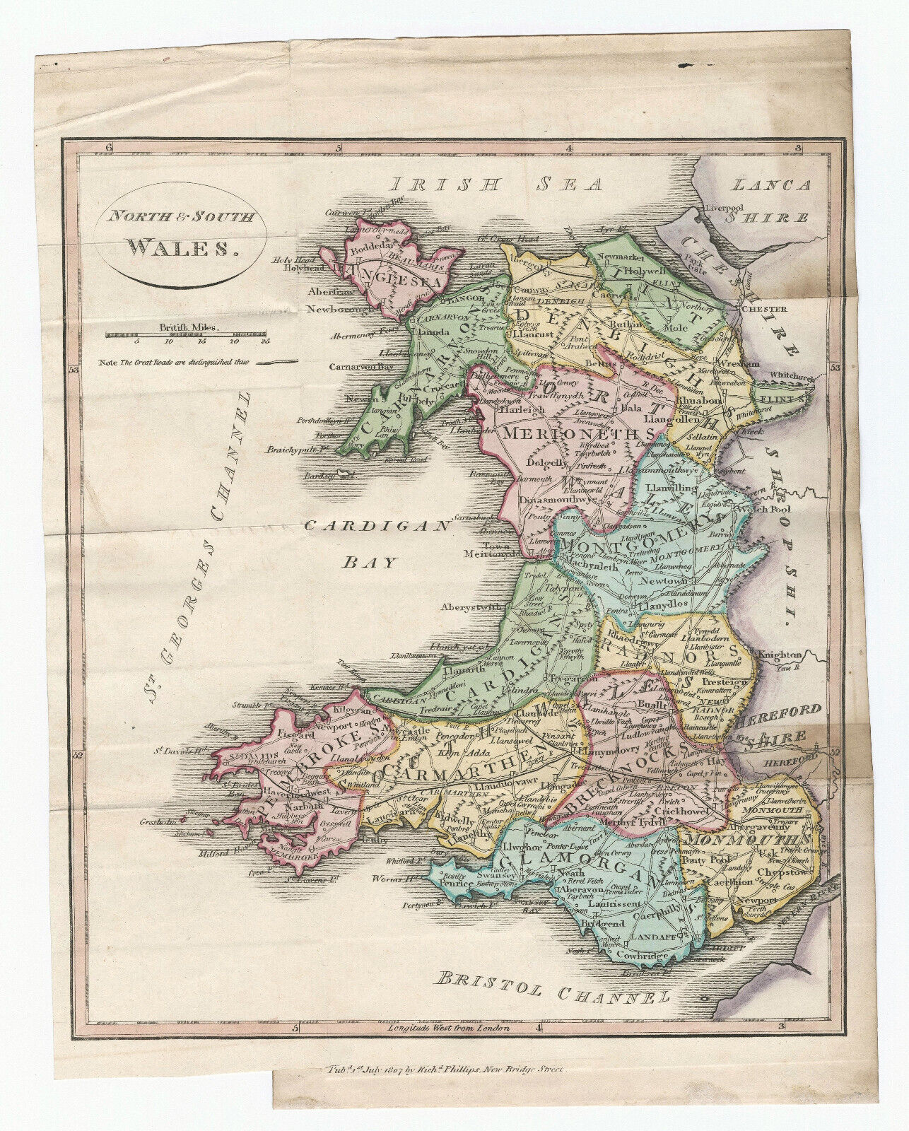
Antique Map "North & South Wales" R. Phillips, 1807

GBP 90.00
ApproximatelyRM 513.93
or Best Offer
Condition:
Oops! Looks like we're having trouble connecting to our server.
Refresh your browser window to try again.
Shipping:
GBP 18.00 (approx RM 102.79) Royal Mail International Tracked.
Located in: London, United Kingdom
Delivery:
Estimated between Tue, 12 Aug and Mon, 18 Aug
Returns:
No returns accepted.
Coverage:
Read item description or contact seller for details. See all detailsSee all details on coverage
(Not eligible for eBay purchase protection programmes)
Seller assumes all responsibility for this listing.
eBay item number:335306032591
Item specifics
- Format
- Sheet Map
- Era
- 1800s
- Printing Technique
- Copper Plate
- Year
- 1807
- Country/Region
- Wales
- Cartographer/Publisher
- Richard Phillips
- Antique
- Yes
- Date Range
- 1800-1899
- Type
- Physical Map
- Original/Reproduction
- Antique Original
Item description from the seller

Popular categories from this store
Seller feedback (303)
- eBay automated Feedback- Feedback left by buyer.Past monthOrder completed successfully – tracked and on time
- eBay automated Feedback- Feedback left by buyer.Past monthOrder completed successfully – tracked and on time
- eBay automated Feedback- Feedback left by buyer.Past monthOrder completed successfully – tracked and on time
More to explore :
- New South Wales Antique Australia/Oceania Maps & Atlases,
- New South Wales Antique Australia/Oceania Atlas Maps,
- New South Wales Antique Original Antique Australia/Oceania Atlas Maps,
- New South Wales Antique Original Antique Australia/Oceania Maps & Atlases,
- New South Wales Lithography Antique Australia/Oceania Maps & Atlases,
- South Carolina Antique North America Maps & Atlases,
- Antique North American Maps & Atlases South Dakota,
- Wales Antique Europe County Maps,
- South Dakota Antique North America Atlas Maps,
- South Dakota Antique North America Folding Maps
Popular categories from this store
Seller feedback (303)
- eBay automated Feedback- Feedback left by buyer.Past monthOrder completed successfully – tracked and on time
- eBay automated Feedback- Feedback left by buyer.Past monthOrder completed successfully – tracked and on time
- eBay automated Feedback- Feedback left by buyer.Past monthOrder completed successfully – tracked and on time