Picture 1 of 9


Gallery
Picture 1 of 9


Have one to sell?
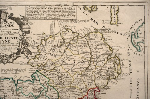
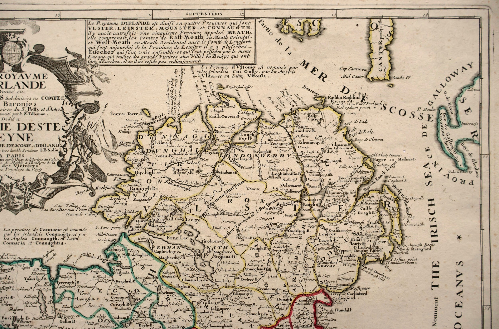
Antique Map "Le Royaume D'Irlande Divise en Provinces" (Ireland) Nolin, 1690

GBP 420.00
ApproximatelyRM 2,375.83
or Best Offer
Condition:
Oops! Looks like we're having trouble connecting to our server.
Refresh your browser window to try again.
Shipping:
GBP 18.00 (approx RM 101.82) International Tracked Postage.
Located in: London, United Kingdom
Delivery:
Estimated between Wed, 8 Oct and Fri, 24 Oct
Returns:
No returns accepted.
Coverage:
Read item description or contact seller for details. See all detailsSee all details on coverage
(Not eligible for eBay purchase protection programmes)
Seller assumes all responsibility for this listing.
eBay item number:335205369453
Item specifics
- Format
- Sheet Map
- Era
- 1600s
- Printing Technique
- Copper Plate
- Year
- 1690
- Country/Region
- Ireland
- Cartographer/Publisher
- Jean-Baptiste Nolin
- Antique
- Yes
- Date Range
- 1600-1699
- Type
- Physical Map
- Original/Reproduction
- Antique Original
Item description from the seller

Popular categories from this store
Seller feedback (319)
- l***e (2045)- Feedback left by buyer.Past monthVerified purchasenice description, fast delivery
- Automatische feedback van eBay- Feedback left by buyer.Past monthBestelling voltooid - getrackt en op tijd
- a***u (0)- Feedback left by buyer.Past monthVerified purchaseVery nice original piece, excellent service
More to explore :
- Ireland Antique Europe Maps & Atlases,
- Ireland Antique Europe Sheet Maps,
- Ireland Antique Europe Atlas Maps,
- Ireland Antique Europe City Maps,
- Ireland Antique Europe Folding Maps,
- Ireland Antique Original Antique Europe County Maps,
- Antique European Maps & Atlases London Ireland,
- Ireland Wicklow Antique Europe County Maps,
- Dublin Ireland Antique Europe Atlas Maps,
- Ireland Lithography Antique Europe County Maps
Popular categories from this store
Seller feedback (319)
- l***e (2045)- Feedback left by buyer.Past monthVerified purchasenice description, fast delivery
- Automatische feedback van eBay- Feedback left by buyer.Past monthBestelling voltooid - getrackt en op tijd
- a***u (0)- Feedback left by buyer.Past monthVerified purchaseVery nice original piece, excellent service