Picture 1 of 7


Gallery
Picture 1 of 7


Have one to sell?
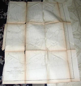
1855 Jeff Davis Map, W. Boundary of Missouri to Trap Creek Map #1

US $34.95
ApproximatelyRM 148.30
Condition:
“See Item Description”
Oops! Looks like we're having trouble connecting to our server.
Refresh your browser window to try again.
Shipping:
US $6.02 (approx RM 25.54) USPS Ground Advantage®.
Located in: Bristol, Pennsylvania, United States
Delivery:
Estimated between Thu, 24 Jul and Wed, 30 Jul to 94104
Returns:
No returns accepted.
Coverage:
Read item description or contact seller for details. See all detailsSee all details on coverage
(Not eligible for eBay purchase protection programmes)
Seller assumes all responsibility for this listing.
eBay item number:334532353705
Item specifics
- Seller Notes
- “See Item Description”
- Publication Year
- 1855
- Date Range
- 1800-1899
- Type
- Map
- US State
- Missouri
- Printing Technique
- Engraving
- Year
- 1855
- Topic
- Maps
- Country/Region
- United States of America
- Maker
- Jefferson Davis
- Date
- 1855
- Subject
- Railroad Map
Item description from the seller

Popular categories from this store
Seller feedback (6,589)
- l***0 (5966)- Feedback left by buyer.Past monthVerified purchaseFast shipment! Smooth transaction! Would do business with again! Thanks!
- 7***n (4)- Feedback left by buyer.Past monthVerified purchaseFast shipping and the ring is beautiful. It is as described.
- l***p (5280)- Feedback left by buyer.Past monthVerified purchaseVintage photo is exactly as described. Shipping was quick. Packaging was safe and secure. I am more than pleased with this transaction. A pleasure to shop here. Many thanks for makig it so easy for overseas buyers. Best wishes from Oz!
More to explore :
- Missouri River Map Antique North America Folding Maps,
- Missouri City Map Antique North America Atlas Maps,
- Missouri Topographical Map Antique North America Folding Maps,
- Missouri County Map Antique North America Atlas Maps,
- Missouri County Map Antique North America School Maps,
- Antique North American Maps & Atlases Missouri,
- Missouri Antique North America City Maps,
- Missouri Antique North America Sheet Maps,
- Missouri Antique North America Railroad Maps,
- Vintage Reproduction Antique North American Maps & Atlases Missouri
Popular categories from this store
Seller feedback (6,589)
- l***0 (5966)- Feedback left by buyer.Past monthVerified purchaseFast shipment! Smooth transaction! Would do business with again! Thanks!
- 7***n (4)- Feedback left by buyer.Past monthVerified purchaseFast shipping and the ring is beautiful. It is as described.
- l***p (5280)- Feedback left by buyer.Past monthVerified purchaseVintage photo is exactly as described. Shipping was quick. Packaging was safe and secure. I am more than pleased with this transaction. A pleasure to shop here. Many thanks for makig it so easy for overseas buyers. Best wishes from Oz!