
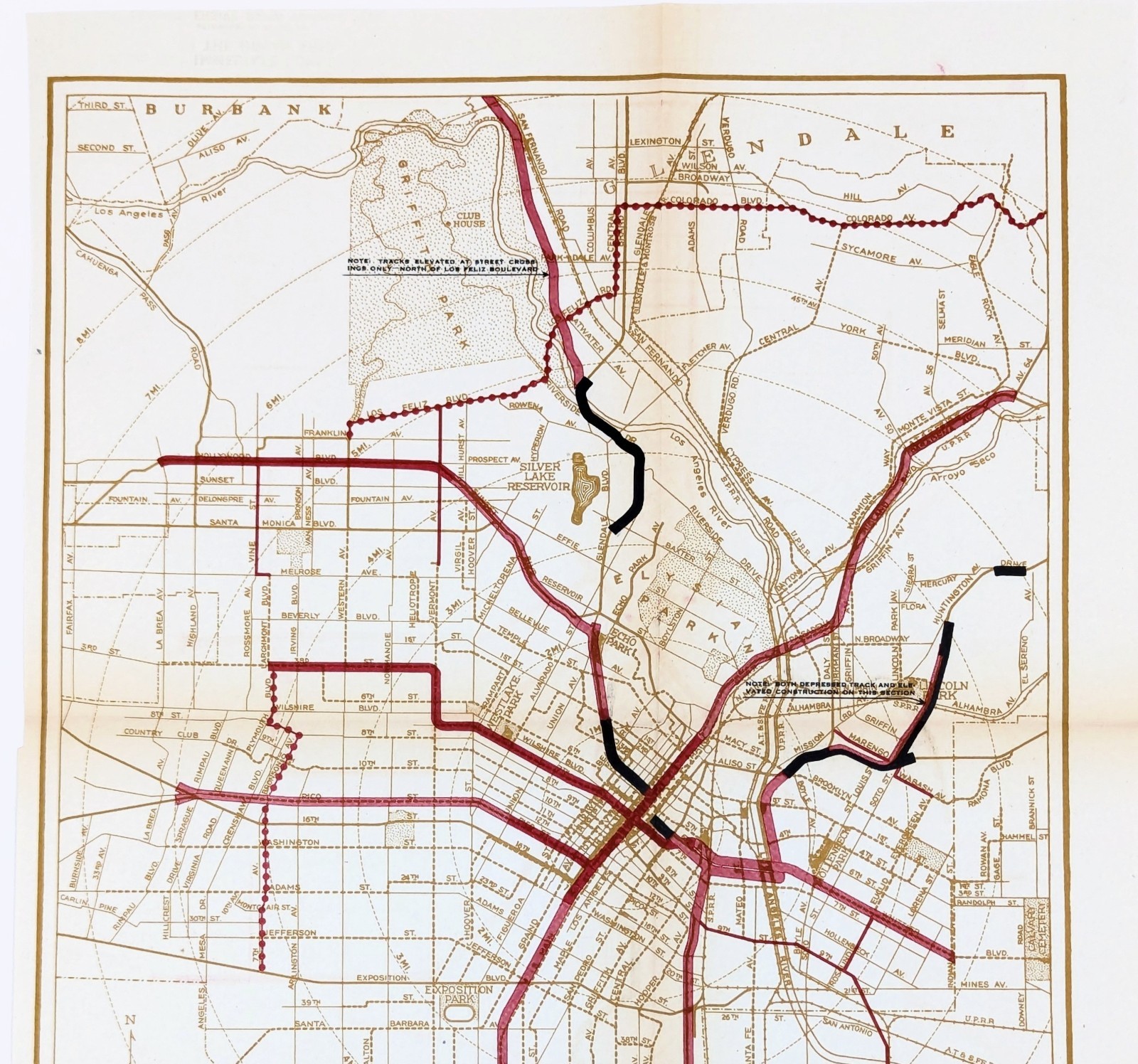
1925 LOS ANGELES - RAPID TRANSIT LINES PLAN Map ORIGINAL SUBWAY ELEVATED BUS
US $94.00US $94.00
Sep 09, 00:23Sep 09, 00:23
Picture 1 of 4


Gallery
Picture 1 of 4


Have one to sell?
1925 LOS ANGELES - RAPID TRANSIT LINES PLAN Map ORIGINAL SUBWAY ELEVATED BUS
US $94.00
ApproximatelyRM 397.22
or Best Offer
Condition:
“GOOD CONDITION, DISCOLORATION AT CREASES, CREASES AS ISSUED”
Oops! Looks like we're having trouble connecting to our server.
Refresh your browser window to try again.
Shipping:
US $6.00 (approx RM 25.35) USPS Ground Advantage®.
Located in: Carefree, Arizona, United States
Delivery:
Estimated between Thu, 23 Oct and Wed, 29 Oct
Returns:
30 days return. Seller pays for return shipping.
Coverage:
Read item description or contact seller for details. See all detailsSee all details on coverage
(Not eligible for eBay purchase protection programmes)
Seller assumes all responsibility for this listing.
eBay item number:326734852479
Item specifics
- Seller Notes
- “GOOD CONDITION, DISCOLORATION AT CREASES, CREASES AS ISSUED”
- Date Range
- 1920-1929
- Type
- City Map
- US State
- California
- Format
- Sheet Map
- Printing Technique
- Lithography
- Year
- 1925
- Original/Reproduction
- Antique Original
- Cartographer/Publisher
- Kelker, De Leuw & Company
- City
- Los Angeles
- Country/Region of Manufacture
- United States
- Country/Region
- United States of America
Item description from the seller
Seller Feedback
No feedback yet
More to explore :
- Los Angeles Vintage Original Antique North America Folding Maps,
- Los Angeles Vintage Original Antique North America Geological Maps,
- Los Angeles Antique Original Antique North America Maps & Atlases,
- Los Angeles Vintage Original Antique North America Maps & Atlases,
- Antique North American Maps & Atlases Los Angeles,
- Los Angeles Antique North America Geological Maps,
- Los Angeles California Antique North America Folding Maps,
- Los Angeles California Antique North America City Maps,
- Antique Original Antique Isothermic Line Maps,
- Los Angeles Antique North American Maps & Atlases 1910-1919 Date Range