Picture 1 of 4


Gallery
Picture 1 of 4


Have one to sell?
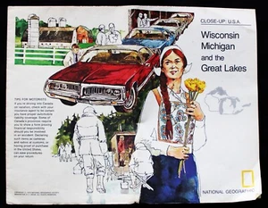
THE NATIONAL GEOGRAPHIC MAP CLOSE UP USA WISCONSIN & MICHIGAN 1973 VINTAGE

US $5.49
ApproximatelyRM 23.26
Condition:
“Authentic original”
Oops! Looks like we're having trouble connecting to our server.
Refresh your browser window to try again.
Shipping:
US $8.65 (approx RM 36.64) USPS Ground Advantage®.
Located in: Rochester, New York, United States
Save on combined shipping
Delivery:
Estimated between Tue, 12 Aug and Mon, 18 Aug to 94104
Returns:
30 days return. Seller pays for return shipping.
Coverage:
Read item description or contact seller for details. See all detailsSee all details on coverage
(Not eligible for eBay purchase protection programmes)
Shop with confidence
Seller assumes all responsibility for this listing.
eBay item number:324145376032
Item specifics
- Seller Notes
- “Authentic original”
- Cartographer/Publisher
- NATIONAL GEOGRAPHIC
- Country/Region
- United States of America
- Date Range
- 1970-1979
- Format
- Folding Map
- Original/Reproduction
- Antique Original
- Printing Technique
- Lithography
- Type
- Political Map
- US State
- Michigan, Wisconsin
- Year
- 1973
Item description from the seller

Seller feedback (30,892)
- u***u (3071)- Feedback left by buyer.Past monthVerified purchaseExcellent five-star transaction! Exactly as described! Fast shipping! Thanks!
- h***d (206)- Feedback left by buyer.Past monthVerified purchaseA+
- h***d (206)- Feedback left by buyer.Past monthVerified purchaseA+
More to explore :
- Antique Wisconsin Maps & Atlases,
- Vintage Reproduction Antique North American Maps for Wisconsin,
- Antique North America Michigan Maps,
- Wisconsin Vintage Original Antique North America County Maps,
- Wisconsin Vintage Original Antique North American Maps & Atlases,
- Wisconsin City Map Antique North America Atlas Maps,
- Michigan County Map Antique North America Atlas Maps,
- Michigan City Map Antique North America Atlas Maps,
- Michigan Topographical Map Antique North America Folding Maps,
- Wisconsin Antique North America River Maps
Seller feedback (30,892)
- u***u (3071)- Feedback left by buyer.Past monthVerified purchaseExcellent five-star transaction! Exactly as described! Fast shipping! Thanks!
- h***d (206)- Feedback left by buyer.Past monthVerified purchaseA+
- h***d (206)- Feedback left by buyer.Past monthVerified purchaseA+