Picture 1 of 5


Gallery
Picture 1 of 5


Have one to sell?
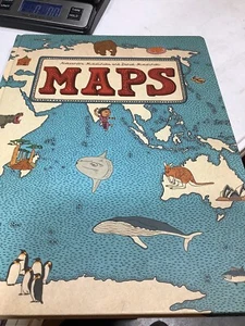
MAPS Aleksandra Mizielinska and Daniel Mizielinski NEW BOOKS
US $20.00
ApproximatelyRM 84.86
or Best Offer
Was US $25.00 (20% off)
Condition:
Brand New
A new, unread, unused book in perfect condition with no missing or damaged pages.
4 available2 sold
Oops! Looks like we're having trouble connecting to our server.
Refresh your browser window to try again.
Shipping:
US $5.99 (approx RM 25.42) USPS Media MailTM.
Located in: Belton, Missouri, United States
Delivery:
Estimated between Thu, 24 Jul and Tue, 29 Jul to 94104
Returns:
30 days return. Buyer pays for return shipping. If you use an eBay shipping label, it will be deducted from your refund amount.
Coverage:
Read item description or contact seller for details. See all detailsSee all details on coverage
(Not eligible for eBay purchase protection programmes)
Shop with confidence
Seller assumes all responsibility for this listing.
eBay item number:296997184032
Item specifics
- Condition
- Brand New: A new, unread, unused book in perfect condition with no missing or damaged pages. See all condition definitionsopens in a new window or tab
- Release Year
- 2013
- ISBN
- 9780763668969
About this product
Product Identifiers
Publisher
Candlewick Press
ISBN-10
0763668966
ISBN-13
9780763668969
eBay Product ID (ePID)
160049114
Product Key Features
Book Title
Maps
Number of Pages
112 Pages
Language
English
Topic
People & Places / General, Reference / Atlases, Social Science / Customs, Traditions, Anthropology, Science & Nature / Earth Sciences / Geography
Publication Year
2013
Genre
Juvenile Nonfiction
Format
Picture Book
Dimensions
Item Height
0.7 in
Item Weight
43.5 Oz
Item Length
14.8 in
Item Width
11 in
Additional Product Features
Intended Audience
Juvenile Audience
Dewey Edition
23
Reviews
[A] sumptuous illustrated children's atlas that combines chic, muted colors with witty and informative drawings on heavy matte paper that whispers under the fingers. ... The sort of book you can't help touching, "Maps" is as likely to engross adults as it is 7- to 10-year-olds. ... [I]t gives aesthetic pleasure all the way from the table of contents to the flags of the world at book's end. -The Wall Street Journal This handsome and fun-to-browse volume will inspire armchair travelers. ... The artwork's muted earth tones, decorative borders, and fine-lined drawings are reminiscent of an antique rendering, while the numerous small cartoon illustrations add a light, contemporary touch. ... [W]insome renderings. -School Library Journal [A] nonfiction visual feast... [G]loriously portrays the world's profusion of creatures, mountains and man-made structures in chic, subdued shades of beige, mauve and eau de Nil. -The Wall Street Journal, [A] sumptuous illustrated children's atlas that combines chic, muted colors with witty and informative drawings on heavy matte paper that whispers under the fingers. ... The sort of book you can't help touching, "Maps" is as likely to engross adults as it is 7- to 10-year-olds. ... [I]t gives aesthetic pleasure all the way from the table of contents to the flags of the world at book's end. -The Wall Street Journal This handsome and fun-to-browse volume will inspire armchair travelers. ... The artwork's muted earth tones, decorative borders, and fine-lined drawings are reminiscent of an antique rendering, while the numerous small cartoon illustrations add a light, contemporary touch. ... [W]insome renderings. -School Library Journal [A] nonfiction visual feast... [G]loriously portrays the world's profusion of creatures, mountains and man-made structures in chic, subdued shades of beige, mauve and eau de Nil. -The Wall Street Journal A visual extravaganza with fascinating trivia in pages as spacious and luxurious as a classic road atlas. It's an invitation to travel around the world one page at a time. ... "Maps" is a treat, with its richness of details catering to young readers in this electronic age who thrive on all kinds of visual stimuli. This book will also appeal to other members of the family. All will scour for details and trivia as obscure, fun and varied as where one might sandboard or see a yak. -Shelf Awareness for Readers Not exactly your library's world atlas. These maps, illustrated in distinctive style by the authors, denote the culture and history of a place rather than its exact coordinates. -Entertainment Weekly [F]eatures playful line drawings of national and geographical attributes, including famous native folk (Freud, Kandinsky, Count Dracula). ... [A]n entertaining and informative choice for budding geographers or Eurail travelers-to-be. -The New York Times Book Review, [A] sumptuous illustrated children's atlas that combines chic, muted colors with witty and informative drawings on heavy matte paper that whispers under the fingers. ... The sort of book you can't help touching, "Maps" is as likely to engross adults as it is 7- to 10-year-olds. ... [I]t gives aesthetic pleasure all the way from the table of contents to the flags of the world at book's end. -The Wall Street Journal This handsome and fun-to-browse volume will inspire armchair travelers. ... The artwork's muted earth tones, decorative borders, and fine-lined drawings are reminiscent of an antique rendering, while the numerous small cartoon illustrations add a light, contemporary touch. ... [W]insome renderings. -School Library Journal [A] nonfiction visual feast... [G]loriously portrays the world's profusion of creatures, mountains and man-made structures in chic, subdued shades of beige, mauve and eau de Nil. -The Wall Street Journal A visual extravaganza with fascinating trivia in pages as spacious and luxurious as a classic road atlas. It's an invitation to travel around the world one page at a time. ... "Maps" is a treat, with its richness of details catering to young readers in this electronic age who thrive on all kinds of visual stimuli. This book will also appeal to other members of the family. All will scour for details and trivia as obscure, fun and varied as where one might sandboard or see a yak. -Shelf Awareness for Readers, [A] sumptuous illustrated children's atlas that combines chic, muted colors with witty and informative drawings on heavy matte paper that whispers under the fingers. ... The sort of book you can't help touching, "Maps" is as likely to engross adults as it is 7- to 10-year-olds. ... [I]t gives aesthetic pleasure all the way from the table of contents to the flags of the world at book's end. -The Wall Street Journal This handsome and fun-to-browse volume will inspire armchair travelers. ... The artwork's muted earth tones, decorative borders, and fine-lined drawings are reminiscent of an antique rendering, while the numerous small cartoon illustrations add a light, contemporary touch. ... [W]insome renderings. -School Library Journal, [F]eatures playful line drawings of national and geographical attributes, including famous native folk (Freud, Kandinsky, Count Dracula). ... [A]n entertaining and informative choice for budding geographers or Eurail travelers-to-be. --The New York Times Book Review [A] delight to explore, as the Mizielinskis fill their maps with tiny labeled images of local wildlife, cuisine, activities, and notable citizens... Compelling. --Publishers Weekly Handsomely detailed illustrations include major industries, regional insects, birds, fish, and other animals, plants, crops and prepared food, and famous people. ... This book supports and encourages geographic literacy. --Library Media Connection (highly recommended) [R]ewarding fare ... for both young cartografiends and armchair travelers. --Kirkus Reviews This handsome and fun-to-browse volume will inspire armchair travelers. ... The artwork's muted earth tones, decorative borders, and fine-lined drawings are reminiscent of an antique rendering, while the numerous small cartoon illustrations add a light, contemporary touch. ... [W]insome renderings. --School Library Journal At once a celebration of diversity and an investigation of the natural and cultural offerings that make each country unique, this expansive and impressive book of maps ... is richly detailed with dozens of extraordinary drawings... Hours of fascinating perusal await. --Foreword Reviews There is no dearth of atlases for children, but Aleksandra and Daniel Mizielinski's "Maps" is a standout. ... [The authors'] enthusiasm and love for facts kids might want to know shine forth in charming little illustrations. --Newsday [A] sumptuous illustrated children's atlas that combines chic, muted colors with witty and informative drawings on heavy matte paper that whispers under the fingers. ... The sort of book you can't help touching, "Maps" is as likely to engross adults as it is 7- to 10-year-olds. ... [I]t gives aesthetic pleasure all the way from the table of contents to the flags of the world at book's end. --The Wall Street Journal [A] nonfiction visual feast... [G]loriously portrays the world's profusion of creatures, mountains and man-made structures in chic, subdued shades of beige, mauve and eau de Nil. --The Wall Street Journal A visual extravaganza with fascinating trivia in pages as spacious and luxurious as a classic road atlas. It's an invitation to travel around the world one page at a time. ... "Maps" is a treat, with its richness of details catering to young readers in this electronic age who thrive on all kinds of visual stimuli. This book will also appeal to other members of the family. All will scour for details and trivia as obscure, fun and varied as where one might sandboard or see a yak. --Shelf Awareness for Readers Along with geographical features and pictures, you'll find amusing depictions of indigenous animals, native dress and characteristic architecture... Between the buildings, food and history, the maps will awaken a wanderlust for unfamiliar and exotic locale. --Metro Philadelphia Not exactly your library's world atlas. These maps, illustrated in distinctive style by the authors, denote the culture and history of a place rather than its exact coordinates. --Entertainment Weekly, [A] sumptuous illustrated children's atlas that combines chic, muted colors with witty and informative drawings on heavy matte paper that whispers under the fingers. ... The sort of book you can't help touching, "Maps" is as likely to engross adults as it is 7- to 10-year-olds. ... [I]t gives aesthetic pleasure all the way from the table of contents to the flags of the world at book's end. -The Wall Street Journal
Grade From
Fifth Grade
Grade To
Twelfth Grade
Dewey Decimal
912
Synopsis
Travel the world without leaving your living room. This book of maps is a visual feast for readers of all ages, with lavishly drawn illustrations from the incomparable Mizielinskis. It features not only borders, cities, rivers, and peaks, but also places of historical and cultural interest, eminent personalities, iconic animals and plants, cultural events, and many more fascinating facts associated with every region of our planet.
Item description from the seller
Popular categories from this store
Seller feedback (10,220)
- 8***8 (379)- Feedback left by buyer.Past monthVerified purchaseGreat deal, thank you!
- 3***l (389)- Feedback left by buyer.Past monthVerified purchaseJust as described! Fast shipping!
- i***i (1664)- Feedback left by buyer.Past monthVerified purchaseReceived, thank you!
More to explore :
- Danielle Steel Fiction & Books,
- Danielle Steel Hardcover Books,
- Danielle Steel Fiction Hardcover Books,
- Danielle Steel Fiction Paperbacks Books,
- Fiction Books & Daniel Silva Fiction,
- Fiction Books & Danielle Steel Fiction,
- Nonfiction Books Fiction & Daniel Kahneman,
- Fiction Books & Daniel Defoe Fiction Books in German,
- Daniel Silva Hardcover Illustrated Fiction Books,
- Daniel Silva Action Fiction Fiction & Books