Picture 1 of 4


Picture 1 of 4
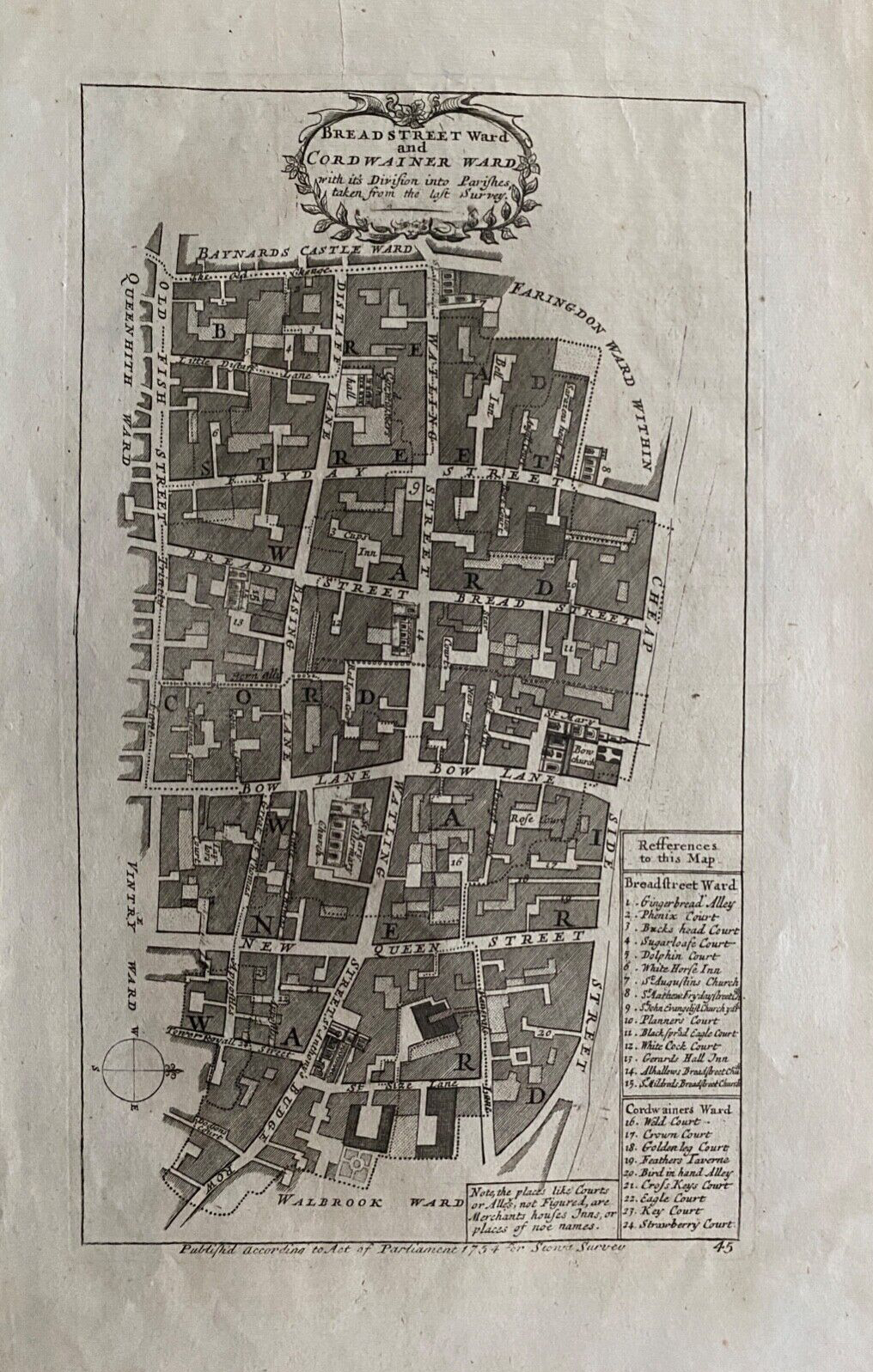


1754 Antique map: Breadstreet & Cordwainer Wards, London: Stow's Survey

GBP 64.99
ApproximatelyRM 362.57
Condition:
“Very good. Suitable for framing. Please check the scan for any blemishes prior to making your ”... Read moreabout condition
Postage:
GBP 15.50 (approx RM 86.47) Royal Mail International Standard.
Located in: Marlow, United Kingdom
Delivery:
Estimated between Wed, 25 Sep and Tue, 1 Oct to 43230
Returns:
30 days return. Buyer pays for return shipping.
Coverage:
Read item description or contact seller for details. See all detailsSee all details on coverage
(Not eligible for eBay purchase protection programmes)
Shop with confidence
Seller assumes all responsibility for this listing.
eBay item number:295463545452
Item specifics
- Seller Notes
- Antique
- Yes
- Date Range
- 1700-1799
- Type
- City Map
- Printing Technique
- Copper Plate
- Format
- Atlas Map
- Year
- 1754
- Era
- 1700s
- Cartographer/Publisher
- Richard Blome
- Original/Reproduction
- Antique Original
- City
- London
- Country/Region
- United Kingdom
- County
- London
Item description from the seller

Seller feedback (13,408)
- 2***1 (1198)- Feedback left by buyer.Past monthVerified purchaseQuick delivery, as described perfect AAA++++
- 7***s (329)- Feedback left by buyer.Past monthVerified purchaseSpeedy delivery and excellent goods - very happy with purchase
- e***- (4)- Feedback left by buyer.Past monthVerified purchaseFantastic print and very quick for delivery. Love it. Thanks!
More to explore :
- Antique Ordnance Survey Maps,
- Antique Europe Ordnance Survey Maps,
- Antique Original Antique Ordnance Survey Maps,
- Vintage Original Antique Ordnance Survey Maps,
- Antique Original Antique Europe Ordnance Survey Maps,
- London London Antique Europe Sheet Maps,
- London England London Antique Europe Maps & Atlases,
- London Antique Europe Folding Maps,
- London United Kingdom European Antique London Maps & Atlases,
- London Wales London Antique Europe Maps & Atlases