Picture 1 of 5


Gallery
Picture 1 of 5


Have one to sell?
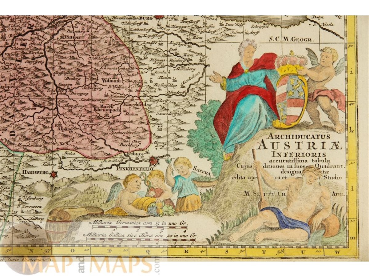
Austria Antique Map – Archiducatus Austriae Inferioris by Seutter, 1740

US $325.00
ApproximatelyRM 1,341.60
or Best Offer
Condition:
“Very good, strong impression, clean hand coloring.”
Oops! Looks like we're having trouble connecting to our server.
Refresh your browser window to try again.
Returns:
No returns accepted.
Coverage:
Read item description or contact seller for details. See all detailsSee all details on coverage
(Not eligible for eBay purchase protection programmes)
About this item
Seller assumes all responsibility for this listing.
eBay item number:286795639164
Item specifics
- Seller Notes
- “Very good, strong impression, clean hand coloring.”
- Date Range
- 1700-1799
- Type
- County Map
- Printing Technique
- Copper Plate
- Format
- Atlas Map
- Year
- 1740
- Original/Reproduction
- Antique Original
- Cartographer/Publisher
- Matthias Seutter
- Country/Region
- Austria
Item description from the seller

Seller feedback (608)
- 1***3 (38)- Feedback left by buyer.Past 6 monthsVerified purchaseSeller promptly ànd accurately responded to a question. Map delivered on time. Good value.Quebec City Plan – Canada by Bellin 1757 (#286552390943)
- b***b (6)- Feedback left by buyer.Past monthVerified purchaseGreat map and very loyal seller. Continue working
- u***t (1586)- Feedback left by buyer.Past 6 monthsVerified purchaseExcellent sellerDescriptio Livoniae.antique map Estonia Latvia Hondius-Bertius 1629 (#286574169757)
This is a private listing and your identity will not be disclosed to anyone except the seller.
More to explore :
- Austria Antique Europe Topographical Maps,
- Antique European Maps & Atlases Austria,
- Austria Antique Europe Folding Maps,
- Austria Antique Europe Political Maps,
- Austria Antique Europe Sheet Maps,
- Austria Antique Europe City Maps,
- Austria Antique Europe Atlas Maps,
- Austria Lithography Antique Europe Sheet Maps,
- Antique European Maps & Atlases Salzburg Austria,
- Austria Vintage Original Antique Europe Maps & Atlases
Seller feedback (608)
- 1***3 (38)- Feedback left by buyer.Past 6 monthsVerified purchaseSeller promptly ànd accurately responded to a question. Map delivered on time. Good value.Quebec City Plan – Canada by Bellin 1757 (#286552390943)
- b***b (6)- Feedback left by buyer.Past monthVerified purchaseGreat map and very loyal seller. Continue working
- u***t (1586)- Feedback left by buyer.Past 6 monthsVerified purchaseExcellent sellerDescriptio Livoniae.antique map Estonia Latvia Hondius-Bertius 1629 (#286574169757)