Picture 1 of 18


Gallery
Picture 1 of 18


Have one to sell?
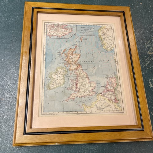
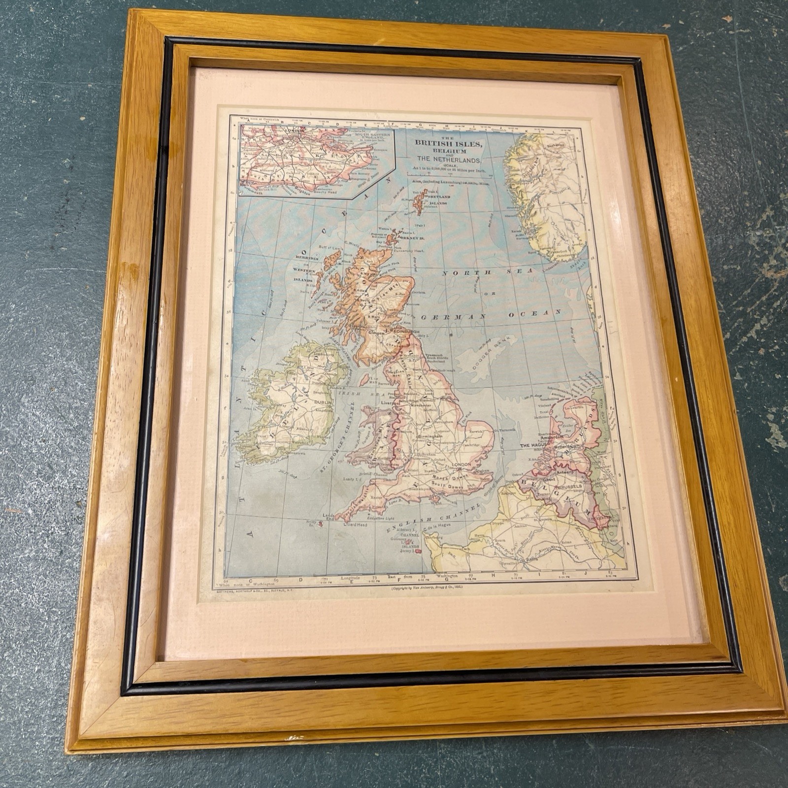
ANTIQUE MAP OF THE BRITISH ISLES BELGIUM AND THE NETHERLANDS FRAMED
US $64.99
ApproximatelyRM 275.88
Condition:
Oops! Looks like we're having trouble connecting to our server.
Refresh your browser window to try again.
Shipping:
Located in: Tipp City, Ohio, United States
Delivery:
Varies
Returns:
No returns accepted.
Coverage:
Read item description or contact seller for details. See all detailsSee all details on coverage
(Not eligible for eBay purchase protection programmes)
Seller assumes all responsibility for this listing.
eBay item number:286746537983
Item specifics
- Date Range
- 1883
- Type
- World Atlas
- Format
- Sheet Map
- Year
- 1911
- Original/Reproduction
- TERRITORIAL
- Cartographer/Publisher
- Rand McNally & Co.
- City
- BRITISH ISLES
- Country/Region of Manufacture
- Belgium
- Country/Region
- Belgium, France, Switzerland
Item description from the seller
Seller feedback (114)
- 4***n (268)- Feedback left by buyer.Past monthVerified purchaseItem looks as if it was never really used in better condition than I perceived
- _***o (109)- Feedback left by buyer.Past monthVerified purchaseShipped very fast, much faster than expected. Packaged well without damage and just as described. Couldn't beat the value to add this old reel to an old bamboo rod!
- t***- (11)- Feedback left by buyer.Past monthVerified purchaseAs advertised. Nice tool. Glad to have it.
More to explore :
- Antique European Maps & Atlases Netherlands,
- Belgium Antique Europe County Maps,
- Belgium Antique Europe Sheet Maps,
- Netherlands Antique Europe Sheet Maps,
- Belgium Antique Europe Topographical Maps,
- Belgium Antique Original Antique Europe County Maps,
- Belgium Antique Original Antique Europe Folding Maps,
- Netherlands Antique Original Antique Europe Sheet Maps,
- Belgium Lithography Antique Europe Sheet Maps,
- Antique European Maps & Atlases Antwerp Belgium