Picture 1 of 12


Gallery
Picture 1 of 12


Have one to sell?
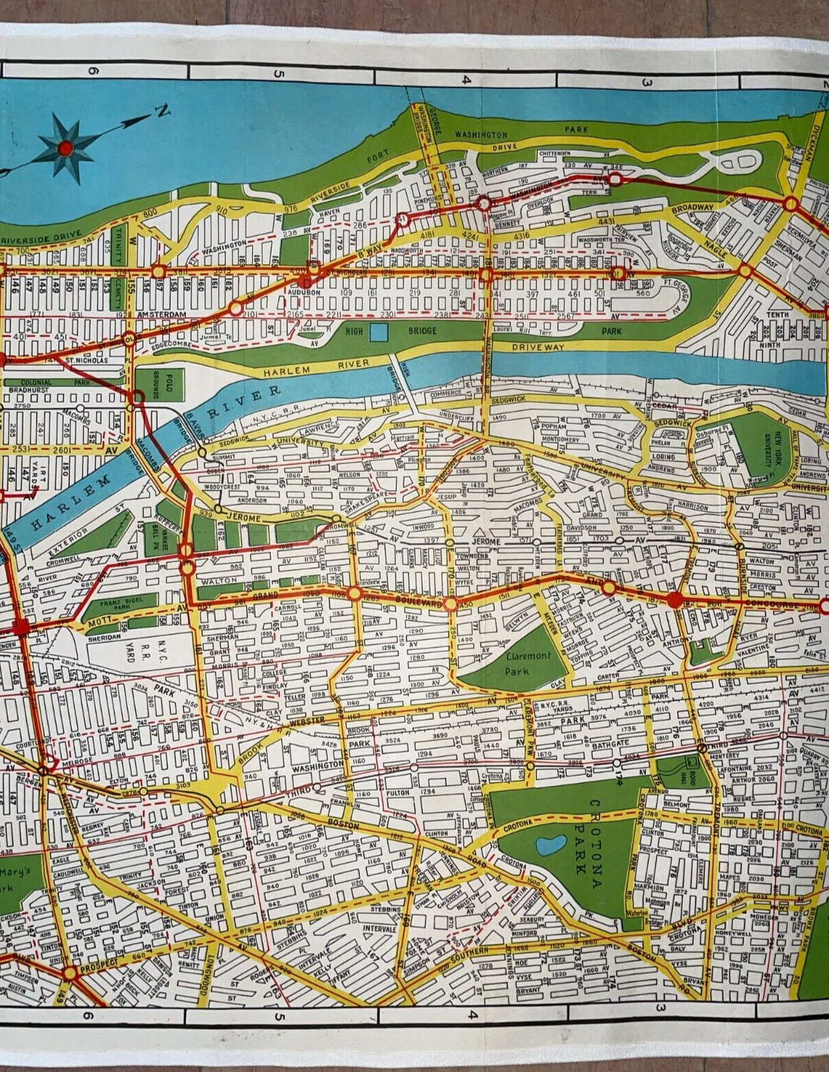
NEW YORK CITY c. 1920 GEORGE J. NOSTRAND VERY LARGE PICTORIAL MAP ON LINEN

US $550.00
ApproximatelyRM 2,333.76
or Best Offer
Condition:
“very good condition”
Oops! Looks like we're having trouble connecting to our server.
Refresh your browser window to try again.
Shipping:
US $38.00 (approx RM 161.24) FedEx Express Saver®.
Located in: Paris, France
Delivery:
Estimated between Wed, 13 Aug and Thu, 14 Aug to 94104
Returns:
14 days return. Buyer pays for return shipping. If you use an eBay shipping label, it will be deducted from your refund amount.
Coverage:
Read item description or contact seller for details. See all detailsSee all details on coverage
(Not eligible for eBay purchase protection programmes)
Shop with confidence
Seller assumes all responsibility for this listing.
eBay item number:285486565800
Item specifics
- Seller Notes
- “very good condition”
- Date Range
- 1920-1929
- Type
- City Map
- Year
- 1920
- Original/Reproduction
- Vintage Original
Item description from the seller
Seller business information
VAT number: FR 12429203854

Popular categories from this store
Seller feedback (2,350)
- *****- Feedback left by buyer.Past monthVerified purchaseBestens, All bests, Danke
- *****- Feedback left by buyer.Past monthVerified purchaseGreat seller! The antique print was perfect. Fast and great communication. Thank you.
- *****- Feedback left by buyer.Past monthVerified purchaseGreat deal!
This is a private listing and your identity will not be disclosed to anyone except the seller.
More to explore :
- New York New York Antique North America City Maps,
- New York 1920-1929 Date Range Antique North America City Maps,
- New York City Map Antique North America Folding Maps,
- New York City Map Antique North America Atlas Maps,
- New York Antique North America City Maps,
- New York New Jersey Antique North America City Maps,
- Brooklyn New York Antique North America City Maps,
- George Cram City Map Antique Atlas Maps,
- New York Antique North American Maps & Atlases 1920-1929 Date Range,
- New York New York Antique North America Wall Maps
Popular categories from this store
Seller feedback (2,350)
- *****- Feedback left by buyer.Past monthVerified purchaseBestens, All bests, Danke
- *****- Feedback left by buyer.Past monthVerified purchaseGreat seller! The antique print was perfect. Fast and great communication. Thank you.
- *****- Feedback left by buyer.Past monthVerified purchaseGreat deal!