Picture 1 of 15


Gallery
Picture 1 of 15


Have one to sell?
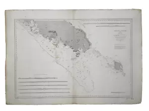
NEW CALEDONIA SOUTH COAST 1861 (1893) VERY LARGE ANTIQUE SEA CHART

US $170.00
ApproximatelyRM 722.50
or Best Offer
Condition:
“very good condition”
Oops! Looks like we're having trouble connecting to our server.
Refresh your browser window to try again.
Shipping:
US $38.00 (approx RM 161.50) FedEx Express Saver®.
Located in: Paris, France
Delivery:
Estimated between Fri, 18 Jul and Sat, 19 Jul to 94104
Returns:
14 days return. Buyer pays for return shipping. If you use an eBay shipping label, it will be deducted from your refund amount.
Coverage:
Read item description or contact seller for details. See all detailsSee all details on coverage
(Not eligible for eBay purchase protection programmes)
Shop with confidence
Seller assumes all responsibility for this listing.
eBay item number:285128460287
Item specifics
- Seller Notes
- “very good condition”
- Type
- Nautical Map
- Format
- Wall Map
- Printing Technique
- Copper Plate
- Original/Reproduction
- Antique Original
Item description from the seller
Seller business information
VAT number: FR 12429203854

Popular categories from this store
Seller feedback (2,345)
- *****- Feedback left by buyer.Past monthVerified purchaseTutto ok grazie
- *****- Feedback left by buyer.Past monthVerified purchasePackaged perfectly in excellent condition. Shipped very quickly.
- *****- Feedback left by buyer.Past monthVerified purchaseTop rated. Great Seller! 🌟
This is a private listing and your identity will not be disclosed to anyone except the seller.
More to explore :
- New Caledonia Antique Australia/Oceania Maps & Atlases,
- US Coast Guard Antique Maritime Navigational Charts,
- Antique Maritime Navigational Charts,
- Antique Reproduction Antique Maritime Navigational Charts,
- Antique Original Antique Maritime Navigational Charts,
- Large Antique Tray,
- Canada Antique Maritime Navigational Charts,
- United States Antique Maritime Navigational Charts,
- Large Antique Stained Glass,
- US Navy Antique Maritime Navigational Charts
Popular categories from this store
Seller feedback (2,345)
- *****- Feedback left by buyer.Past monthVerified purchaseTutto ok grazie
- *****- Feedback left by buyer.Past monthVerified purchasePackaged perfectly in excellent condition. Shipped very quickly.
- *****- Feedback left by buyer.Past monthVerified purchaseTop rated. Great Seller! 🌟