Picture 1 of 6


Gallery
Picture 1 of 6


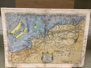
C. 1740 A Map Of The Western Province Of The Kingdom Of Algiers 13.5 x 19”

US $150.00
ApproximatelyRM 638.03
or Best Offer
Condition:
Oops! Looks like we're having trouble connecting to our server.
Refresh your browser window to try again.
Pickup:
Free local pickup from Harrisburg, Pennsylvania, United States.
Shipping:
US $22.95 (approx RM 97.62) USPS Priority Mail®.
Located in: Harrisburg, Pennsylvania, United States
Delivery:
Estimated between Thu, 26 Jun and Wed, 2 Jul to 94104
Returns:
30 days return. Buyer pays for return shipping. If you use an eBay shipping label, it will be deducted from your refund amount.
Coverage:
Read item description or contact seller for details. See all detailsSee all details on coverage
(Not eligible for eBay purchase protection programmes)
Shop with confidence
Seller assumes all responsibility for this listing.
eBay item number:284442493063
Item specifics
- Map View
- North Africa
- Original/Reproduction
- Antique Original
- Type
- Topographical Map
- Year
- 1740
- Date Range
- 1700-1799
Item description from the seller

Popular categories from this store
Seller feedback (3,398)
- f***c (286)- Feedback left by buyer.Past monthVerified purchaseAwesome deal
- t***s (644)- Feedback left by buyer.Past monthVerified purchasePerfect!
- s***m (388)- Feedback left by buyer.Past monthVerified purchasePacked with care, THANKS
More to explore :
- Antique African Maps & Atlases Algiers,
- Antique African Maps & Atlases Algiers Algeria,
- Algiers Antique Original Antique Africa Maps & Atlases,
- Antique African Maps & Atlases Algiers 1800-1899 Date Range,
- Antique African Maps & Atlases Algiers 1700-1799 Date Range,
- United Kingdom Antique Europe Maps & Atlases,
- Western Hemisphere Physical Map Antique World Sheet Maps,
- Western Hemisphere Antique World Maps & Atlases,
- United Kingdom London Antique Europe Atlas Maps,
- John Speed United Kingdom Antique European Maps & Atlases
Popular categories from this store
Seller feedback (3,398)
- f***c (286)- Feedback left by buyer.Past monthVerified purchaseAwesome deal
- t***s (644)- Feedback left by buyer.Past monthVerified purchasePerfect!
- s***m (388)- Feedback left by buyer.Past monthVerified purchasePacked with care, THANKS