Picture 1 of 4


Gallery
Picture 1 of 4


Have one to sell?
National Geographic - Hardcover, by National Geographic Society - Very Good
US $95.18
ApproximatelyRM 398.76
or Best Offer
Was US $135.97 (30% off)
Condition:
“Boom, Brainpower, and Book Smarts! This textbook is in very good condition--gently used with only ”... Read moreabout condition
Sale ends in: 2d 21h
Oops! Looks like we're having trouble connecting to our server.
Refresh your browser window to try again.
Shipping:
US $8.04 (approx RM 33.68) UPS Ground Saver.
Located in: Minneapolis, Minnesota, United States
Delivery:
Estimated between Thu, 6 Nov and Fri, 14 Nov to 94104
Returns:
30 days return. Buyer pays for return shipping. If you use an eBay shipping label, it will be deducted from your refund amount.
Coverage:
Read item description or contact seller for details. See all detailsSee all details on coverage
(Not eligible for eBay purchase protection programmes)
Seller assumes all responsibility for this listing.
eBay item number:277308173251
Item specifics
- Condition
- Very Good
- Seller Notes
- Book Title
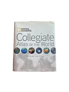
- National Geographic Collegiate Atlas of the World, 2nd Edition
- Country
- United States
- Personalized
- No
- Region
- World
- Features
- Illustrated
- Country/Region of Manufacture
- United States
- ISBN
- 9781426208393
About this product
Product Information
Two opening spreads in the front matter help the reader to better interpret images and new data. "Remote World" introduces readers to data collection via remote sensing and GPS technology. "Understanding Our World Spatially" follows, covering data processing and analysis as it relates to mapping and using GIS technology (Geographic Information Systems). These explanatory introductory pieces provide the foundation for students to gain insight into modern-day map making, which is reflected in the content of the colorful, engaging, fact-filled spreads that lie ahead. The atlas also addresses the traditional subjects of map scales, projections, and map reading skills. Based on feedback from more than 100 professors, educational reviewers, and other consultants, we have added special thematic map spreads addressing each Continental Economy. In addition--within each continent--physical, political, and regional mapping is presented at the same scale, which allows the reader to compare map information easily and accurately. This feature of a fixed scale for regions provides the reader the option to roam from one end of a continent to its other end, flipping through the pages, while maintaining a constant scale. The atlas is organized as follows: The Front matter with its new spreads on data collection and then data processing. The World: with 25 spreads on Natural and Human themes including: Tectonics, the Biosphere, World Energy, World Health, Nutrition, and Literacy, and Technology and Globilization. The atlas then zooms into Continental coverage: Like the world thematic section, each of these continental parts will cover many important natural and human themes such as climate, natural hazards, income/GDP, and Trade. In addition, core political, regional coverage completes each continent's signature of human boundaries and places. The fascinating polar regions and the vast world oceans come next. Finally, abundant, clear, and precise appendices provide an invaluable back matter, reference section. A 105-page, place-name index is included as well. Careful selection of place-names and features make the maps very informative but not overly cluttered. Computer-generated shading enhances the look of the political maps while providing valuable information on topography. The ocean floors of the world are dramatically portrayed with bathymetric relief paintings. And lastly, world political information, statistics, geographic comparisons, and glossaries are organized in easy-to-use sections in the back matter--all of this in a manageable, easy-to-handle, value-packed, 400-page, 9 x 11 format.
Product Identifiers
Publisher
Disney Publishing Worldwide
ISBN-10
1426208391
ISBN-13
9781426208393
eBay Product ID (ePID)
102804213
Product Key Features
Number of Pages
400 Pages
Language
English
Publication Name
National Geographic Collegiate Atlas of the World, Second Edition
Publication Year
2011
Subject
Atlases, Gazetteers & Maps (See Also Travel / Maps & Road Atlases), General, Référence
Type
Map
Format
Hardcover
Dimensions
Item Height
1.3 in
Item Weight
58.1 Oz
Item Length
11.1 in
Item Width
9.5 in
Additional Product Features
Edition Number
2
Intended Audience
Trade
Dewey Edition
22
Illustrated
Yes
Dewey Decimal
912
Lc Classification Number
G1021
Item description from the seller
Seller feedback (10)
- g***3 (122)- Feedback left by buyer.Past 6 monthsVerified purchaseOrdered and then got the feedback they were out.Flash Drive 256GB for Iphone USB Memory Stick Thumb Drives High Speed USB Stick, (#277205292936)
- Proceso de votación automática de eBay- Feedback left by buyer.Past 6 monthsEl pedido se ha entregado con puntualidad y sin incidencias
- Proceso de votación automática de eBay- Feedback left by buyer.Past 6 monthsEl pedido se ha entregado con puntualidad y sin incidencias
More to explore :
- National Geographic Hardcovers,
- National Geographic Hardcover Textbooks,
- National Geographic Hardcovers Books,
- National Geographic Hardcover Nonfiction Books,
- National Geographic Study Hardcovers Prep,
- National Geographic Magazines,
- National Geographic History Magazines,
- National Geographic Children Magazines,
- Science National Geographic Magazines,
- National Geographic Learning Staff Nonfiction National Geographic Fiction & Nonfiction Books