
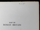
Map of Roman Britain - Ordnance Survey (1956) Large Folding Historical Map 16/1"
GBP 7.53GBP 7.53
Jun 23, 02:08Jun 23, 02:08
Picture 1 of 5


Gallery
Picture 1 of 5


Have one to sell?
Map of Roman Britain - Ordnance Survey (1956) Large Folding Historical Map 16/1"

Condition:
“Folding map of Roman Britain by the Ordnance Survey. Third edition. Scale sixteen miles to an inch, ”... Read moreabout condition
Ended: Jun 23, 2025 02:08:48 MYT
Oops! Looks like we're having trouble connecting to our server.
Refresh your browser window to try again.
Shipping:
GBP 19.99 (approx RM 113.56) Economy Int'l Postage.
Located in: Norwich, United Kingdom
Delivery:
Estimated between Mon, 11 Aug and Tue, 26 Aug to 94104
Returns:
No returns accepted.
Coverage:
Read item description or contact seller for details. See all detailsSee all details on coverage
(Not eligible for eBay purchase protection programmes)
Shop with confidence
Seller assumes all responsibility for this listing.
eBay item number:277209991470
Item specifics
- Seller Notes
- Date Range
- 1956
- Type
- Ordnance Survey Map
- Format
- Folding Map
- Year
- 1956
- Original/Reproduction
- Contemporary
- Cartographer/Publisher
- Ordnance Survey
Item description from the seller
Seller business information
VAT number: GB 288974325

Seller feedback (22,887)
This item (1)
All items (22,887)
- eBay automated Feedback- Feedback left by buyer.Past monthOrder completed successfully – tracked and on time
- eBay automated Feedback- Feedback left by buyer.Past monthOrder completed successfully – tracked and on time
- 5***i (4539)- Feedback left by buyer.Past monthVerified purchaseUsual excellent service A+++++
- 5***i (4539)- Feedback left by buyer.Past monthVerified purchaseGreat ebayer, no problems A+++++
More to explore :
- Antique Ordnance Survey Maps,
- Antique Europe Ordnance Survey Maps,
- Vintage Original Antique Ordnance Survey Maps,
- Antique North America Ordnance Survey Maps,
- Antique Original Antique Ordnance Survey Maps,
- County Map Antique Folding Maps,
- River Map Antique Folding Maps,
- Political Map Antique Folding Maps,
- County Map Antique World Folding Maps,
- Lithography County Map Antique Folding Maps
Seller feedback (22,887)
This item (1)
All items (22,887)
- eBay automated Feedback- Feedback left by buyer.Past monthOrder completed successfully – tracked and on time
- eBay automated Feedback- Feedback left by buyer.Past monthOrder completed successfully – tracked and on time
- 5***i (4539)- Feedback left by buyer.Past monthVerified purchaseUsual excellent service A+++++
- 5***i (4539)- Feedback left by buyer.Past monthVerified purchaseGreat ebayer, no problems A+++++