Picture 1 of 5


Gallery
Picture 1 of 5


Have one to sell?
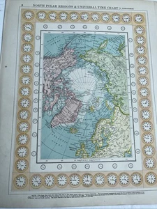
1900: Map Of North Polar Regions & Universal Time Chart Bacon Antique Print GA 3
GBP 14.95
ApproximatelyRM 85.73
or Best Offer
Condition:
Oops! Looks like we're having trouble connecting to our server.
Refresh your browser window to try again.
Shipping:
Located in: Evington, Leicestershire, United Kingdom
Delivery:
Varies
Returns:
No returns accepted.
Coverage:
Read item description or contact seller for details. See all detailsSee all details on coverage
(Not eligible for eBay purchase protection programmes)
Seller assumes all responsibility for this listing.
eBay item number:277080598134
Item specifics
- Map View
- North Polar Region
- Date Range
- 1900-1909
- Antique
- Yes
- Type
- Physical Map
- Format
- Sheet Map
- Year
- 1900
- Era
- 1900s
- Original/Reproduction
- Antique Original
- Cartographer/Publisher
- G. W . Bacon
Item description from the seller
Seller feedback (1,992)
- eBay automated feedback- Feedback left by buyer.Past monthOrder completed successfully—tracked and on time
- eBay automated feedback- Feedback left by buyer.Past monthOrder completed successfully—tracked and on time
- eBay automated feedback- Feedback left by buyer.Past monthOrder completed successfully—tracked and on time
More to explore :
- North Polar Region Antique World Maps & Atlases,
- North Polar Region Antique Original Antique World Maps & Atlases,
- North Polar Region Lithography Antique World Maps & Atlases,
- North Polar Region 1800-1899 Date Range Antique World Maps & Atlases,
- 1900-1909 Date Range Railroad Map Antique North America Folding Maps,
- 1900-1909 Date Range City Map Antique North America Atlas Maps,
- Antique North America Maps & Atlases,
- North Carolina Antique North American Maps & Atlases 1900-1909 Date Range,
- 1900-1909 Date Range Antique North America Sheet Maps,
- 1900-1909 Date Range Antique North America Topographical Maps