Picture 1 of 7


Gallery
Picture 1 of 7


Have one to sell?
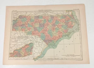
1890 North Carolina Map 9th Edition Encyclopedia Britannica Original Color Print

US $14.99
ApproximatelyRM 63.09
Condition:
“Great condition. No rips, tears or stains.”
Oops! Looks like we're having trouble connecting to our server.
Refresh your browser window to try again.
Shipping:
US $4.95 (approx RM 20.83) USPS Ground Advantage®.
Located in: Bowman, Georgia, United States
Delivery:
Estimated between Fri, 10 Oct and Fri, 17 Oct to 94104
Returns:
30 days return. Buyer pays for return shipping. If you use an eBay shipping label, it will be deducted from your refund amount.
Coverage:
Read item description or contact seller for details. See all detailsSee all details on coverage
(Not eligible for eBay purchase protection programmes)
Seller assumes all responsibility for this listing.
eBay item number:267376564581
Item specifics
- Seller Notes
- “Great condition. No rips, tears or stains.”
- Cartographer/Publisher
- The Henry Allen Company
- Original/Reproduction
- Antique Original
- Format
- Atlas Map
- Type
- Atlas Map
- Year
- 1890
- US State
- North Carolina
- Date Range
- 1800-1899
- City
- All Of North Carolina
- Country/Region
- United States of America
Item description from the seller

Seller feedback (954)
- Évaluations automatiques eBay- Feedback left by buyer.Past monthCommande terminée - avec suivi et dans les délais
- l***i (253)- Feedback left by buyer.Past monthVerified purchaseItems was as described and shipped quickly.
- Évaluations automatiques eBay- Feedback left by buyer.Past monthCommande terminée - avec suivi et dans les délais
More to explore :
- North Carolina Antique Original Antique North America Folding Maps,
- North Carolina Antique Original Antique North America Sheet Maps,
- North Carolina Antique Original Antique North America Maps & Atlases,
- North Carolina Vintage Original Antique North America Maps & Atlases,
- North Carolina Vintage Original Antique North America Folding Maps,
- North Carolina Antique North America Maps & Atlases,
- North Carolina Antique North America Sheet Maps,
- South Carolina Antique Original Antique North America Folding Maps,
- Baltimore North Carolina Antique North America Maps & Atlases,
- North Carolina Contemporary Antique North American Maps & Atlases
Seller feedback (954)
- Évaluations automatiques eBay- Feedback left by buyer.Past monthCommande terminée - avec suivi et dans les délais
- l***i (253)- Feedback left by buyer.Past monthVerified purchaseItems was as described and shipped quickly.
- Évaluations automatiques eBay- Feedback left by buyer.Past monthCommande terminée - avec suivi et dans les délais