Picture 1 of 3


Gallery
Picture 1 of 3


Have one to sell?
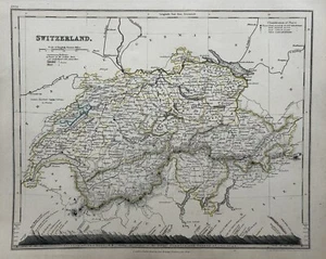
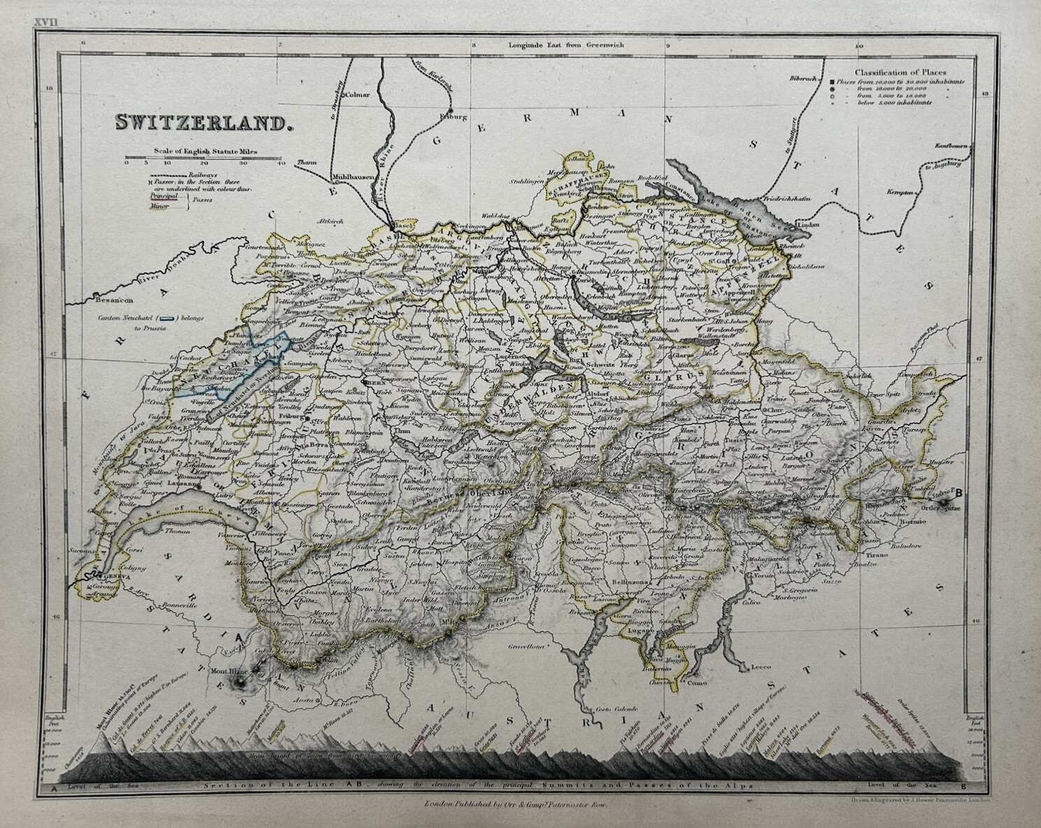
1850 Switzerland Hand Coloured Antique Map By John Dower Showing Mountains

GBP 24.99
ApproximatelyRM 142.15
or Best Offer
Condition:
“The map is in good condition for its age.”
Oops! Looks like we're having trouble connecting to our server.
Refresh your browser window to try again.
Shipping:
GBP 12.00 (approx RM 68.26) Parcelforce Global Express.
Located in: Manchester, United Kingdom
Delivery:
Estimated between Wed, 3 Sep and Thu, 11 Sep to 94104
Returns:
60 days return. Seller pays for return shipping.
Coverage:
Read item description or contact seller for details. See all detailsSee all details on coverage
(Not eligible for eBay purchase protection programmes)
Seller assumes all responsibility for this listing.
eBay item number:257057476518
Item specifics
- Seller Notes
- “The map is in good condition for its age.”
- Date Range
- 1800-1899
- Antique
- Yes
- Type
- Political Map
- Format
- Atlas Map
- Year
- 1850
- Era
- 1800s
- Cartographer/Publisher
- Augustus Petermann
- Original/Reproduction
- Antique Original
- Country/Region
- Switzerland
Item description from the seller

Seller feedback (5,184)
- eBay automated Feedback- Feedback left by buyer.Past monthOrder completed successfully – tracked and on time
- i***e (1874)- Feedback left by buyer.Past monthVerified purchaseGreat. Thanks! A+++++++++++
- i***e (1874)- Feedback left by buyer.Past monthVerified purchaseGreat. Thanks! A++++++++++++
More to explore :
- Switzerland Antique Europe County Maps,
- Switzerland Antique Europe Railroad Maps,
- Switzerland Antique Europe City Maps,
- Antique European Maps & Atlases Switzerland,
- Switzerland Antique Europe Atlas Maps,
- Switzerland Antique Europe Folding Maps,
- Switzerland Topographical Map Antique Europe Atlas Maps,
- Switzerland Antique Original Antique Europe City Maps,
- Antique European Maps & Atlases Bern Switzerland,
- Antique European Maps & Atlases Switzerland Lithography
Seller feedback (5,184)
- eBay automated Feedback- Feedback left by buyer.Past monthOrder completed successfully – tracked and on time
- i***e (1874)- Feedback left by buyer.Past monthVerified purchaseGreat. Thanks! A+++++++++++
- i***e (1874)- Feedback left by buyer.Past monthVerified purchaseGreat. Thanks! A++++++++++++