Picture 1 of 4


Gallery
Picture 1 of 4


Have one to sell?
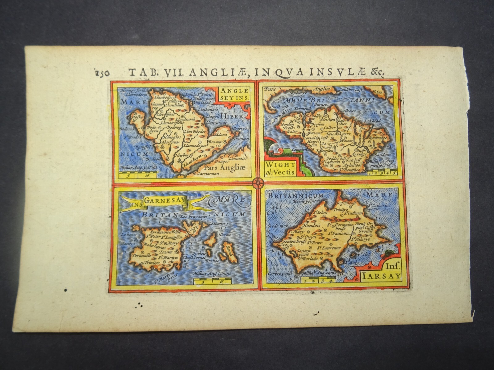
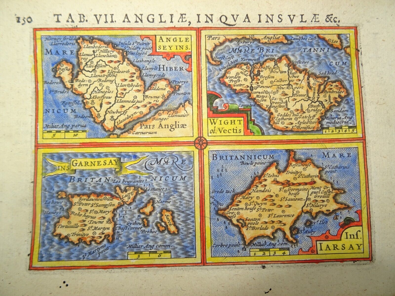
Antique Map of the English Islands by Petrus Bertius 1618

GBP 85.00
ApproximatelyRM 485.39
Condition:
Oops! Looks like we're having trouble connecting to our server.
Refresh your browser window to try again.
Shipping:
GBP 10.00 (approx RM 57.10) Royal Mail International Signed.
Located in: Bath, United Kingdom
Delivery:
Estimated between Mon, 18 Aug and Mon, 25 Aug to 94104
Returns:
No returns accepted.
Coverage:
Read item description or contact seller for details. See all detailsSee all details on coverage
(Not eligible for eBay purchase protection programmes)
Seller assumes all responsibility for this listing.
eBay item number:256487252938
Item specifics
- Date Range
- 1600-1699
- Type
- Topographical Map
- Printing Technique
- Copper Plate
- Year
- 1618
- Era
- 1600s
- Cartographer/Publisher
- Petrus Bertius
- Original/Reproduction
- Antique Original
- Country/Region
- England
- County
- Anglesey, Isle of Wight, Guernsey, Jersey
Item description from the seller

Seller Feedback
Error displaying feedback. Try refreshing the page.
More to explore :
- Rhode Island County Map Antique North America Atlas Maps,
- Antique South American Maps & Atlases Falkland Islands,
- Rhode Island Antique North America Nautical Maps,
- Marshall Islands Antique Australia/Oceania Maps & Atlases,
- Rhode Island Antique North America Folding Maps,
- Rhode Island Antique North America County Maps,
- Falkland Islands Antique Original Antique South America Maps & Atlases,
- Virgin Islands Antique Central American/Caribbean Maps & Atlases,
- Rhode Island Contemporary Antique North America Maps & Atlases,
- Providence Rhode Island Antique North America City Maps
Seller Feedback
Error displaying feedback. Try refreshing the page.