Picture 1 of 2

Gallery
Picture 1 of 2


Have one to sell?
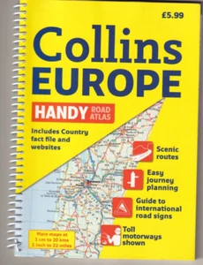
COLLINS EUROPE HANDY ROAD ATLAS (2012 SPIRAL BOUND){Z1}

US $16.00
ApproximatelyRM 67.34
Condition:
Brand New
A new, unread, unused book in perfect condition with no missing or damaged pages.
More than 10 available1 sold
Oops! Looks like we're having trouble connecting to our server.
Refresh your browser window to try again.
Shipping:
Free USPS Media MailTM.
Located in: Oakville, Connecticut, United States
Delivery:
Estimated between Thu, 9 Oct and Wed, 15 Oct to 94104
Returns:
No returns accepted.
Coverage:
Read item description or contact seller for details. See all detailsSee all details on coverage
(Not eligible for eBay purchase protection programmes)
Shop with confidence
Seller assumes all responsibility for this listing.
eBay item number:256338746947
Item specifics
- Condition
- Brand New: A new, unread, unused book in perfect condition with no missing or damaged pages. See all condition definitionsopens in a new window or tab
- Ex Libris
- No
- Narrative Type
- Nonfiction
- ISBN
- 9780007364138
About this product
Product Identifiers
Publisher
HarperCollins The Limited
ISBN-10
000736413X
ISBN-13
9780007364138
eBay Product ID (ePID)
13038199710
Product Key Features
Edition
2
Book Title
Collins Handy Road Atlas Europe
Number of Pages
180 Pages
Language
English
Topic
Maps & Road Atlases (See Also Reference / Atlases, Gazetteers & Maps), Europe / General
Publication Year
2012
Illustrator
Yes
Genre
Travel
Book Series
International Road Atlases Ser.
Format
Spiral
Dimensions
Item Height
0.6 in
Item Weight
10.6 Oz
Item Length
8.7 in
Item Width
6.1 in
Additional Product Features
Intended Audience
Trade
Dewey Edition
23
Dewey Decimal
912.4
Edition Description
New Edition,Revised edition
Synopsis
A handy format road atlas of Europe at 34 miles to 1 inch with lie-flat spiral binding, ideal for both drivers and those traveling by public transport Every major European country is covered in this fully updated road atlas that features a ratio of 34 miles to one inch. Euroroutes and highways are clearly identified as are all international road classifications, scenic routes, and common resorts. A route planning map, information on road signs, country fact files, and a full index of place names complete this ideal travel companion., Scale: 1:2,000,000 Handy road atlas of Europe at A5 format with lie-flat spiral binding. Ideal format for both drivers and those travelling by public transport. Scenic routes are plotted on the maps., Scale: 1:2,000,000 Handy road atlas of Europe at A5 format with lie-flat spiral binding. Ideal format for both drivers and those travelling by public transport. Scenic routes are plotted on the maps. MAIN FEATURES Handy A5 format road atlas of Europe at 34 miles to 1inch. Euroroutes and motorways are easily distinguished on the mapping. The maps also show international road classifications, road distances in kilometres and land height is shown by attractive layer tints. INCLUDES * Route planning maps at 1:6,340,000 with political colouring. * Country fact file. * Distance map and chart. * Information on international road signs. * Main road maps at 1:2,174,000. * Each page has a little locator diagram to help you pinpoint where you are in relation to the rest of Europe. * Full index to place names. * Full updates including new motorways in Ireland, France and Hungary. The maps include: - scenic routes - Euro route numbers WHO THE PRODUCT IS OF INTEREST TO Motorists planning a journey in Europe and for use en route. It is also ideal for those travelling by public transport who would like a neat portable atlas to take with them., Scale: 1:2,000,000 Handy road atlas of Europe at A5 format with lie-flat spiral binding. Ideal format for both drivers and those travelling by public transport. Scenic routes are plotted on the maps. MAIN FEATURES Handy A5 format road atlas of Europe at 34 miles to 1inch. Euroroutes and motorways are easily distinguished on the mapping. The maps also show international road classifications, road distances in kilometres and land height is shown by attractive layer tints. INCLUDES Route planning maps at 1:6,340,000 with political colouring. Country fact file. Distance map and chart. Information on international road signs. Main road maps at 1:2,174,000. Each page has a little locator diagram to help you pinpoint where you are in relation to the rest of Europe. Full index to place names. Full updates including new motorways in Ireland, France and Hungary. The maps include: scenic routes Euro route numbers WHO THE PRODUCT IS OF INTEREST TO Motorists planning a journey in Europe and for use en route. It is also ideal for those travelling by public transport who would like a neat portable atlas to take with them.
Item description from the seller

Seller feedback (11,120)
- c***e (1828)- Feedback left by buyer.Past monthVerified purchaseArrived quickly and in great condition
- i***r (1377)- Feedback left by buyer.Past monthVerified purchaseThank you very much!
- eBay automated Feedback- Feedback left by buyer.Past monthOrder delivered on time with no issues
More to explore :
- Road Atlas,
- Road Atlas Paperbacks,
- Road Atlas in English,
- Leather Bound Fiction & Books,
- 2010-Now Publication Year Road Atlas,
- Nonfiction Books & Fiction Bible Leather Bound,
- Fiction Books & Fiction Leather Bound,
- The Bible Nonfiction Books Fiction & Leather Bound,
- Nonfiction Bible Faux Leather Bound Fiction & Books,
- Suzanne Collins Fiction & Books
Seller feedback (11,120)
- c***e (1828)- Feedback left by buyer.Past monthVerified purchaseArrived quickly and in great condition
- i***r (1377)- Feedback left by buyer.Past monthVerified purchaseThank you very much!
- eBay automated Feedback- Feedback left by buyer.Past monthOrder delivered on time with no issues