Picture 1 of 3


Gallery
Picture 1 of 3


Have one to sell?
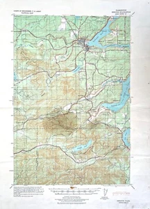
Vintage Shelton, Wash., US Army CoE, Topographical Tactical Map, 1/62500, 1939
US $18.00
ApproximatelyRM 75.93
or Best Offer
Condition:
“in good condition”
Oops! Looks like we're having trouble connecting to our server.
Refresh your browser window to try again.
Shipping:
Free Standard Shipping.
Located in: Port Townsend, Washington, United States
Delivery:
Estimated between Fri, 29 Aug and Wed, 3 Sep to 94104
Returns:
No returns accepted.
Coverage:
Read item description or contact seller for details. See all detailsSee all details on coverage
(Not eligible for eBay purchase protection programmes)
Seller assumes all responsibility for this listing.
eBay item number:255804288544
Item specifics
- Seller Notes
- “in good condition”
- Date Range
- 1900-1909
- Type
- Topographical Map
- Format
- Sheet Map
- Printing Technique
- Copper Plate
- US State
- Washington
- Cartographer/Publisher
- US Army Corps of Engr.
- Original/Reproduction
- Antique Original
- City
- Shelton
- Country/Region
- United States of America
- California Prop 65 Warning
- NA
Item description from the seller
Popular categories from this store
Seller feedback (309)
- b***a (309)- Feedback left by buyer.Past 6 monthsVerified purchaseGood buy
- r***d (2317)- Feedback left by buyer.Past 6 monthsVerified purchaseItem was well described.. shipped and delivered quickly.. well done.. thank you AAA+++
- p***n (70)- Feedback left by buyer.Past 6 monthsVerified purchaseGreat price for excellent collection. Would buy again from seller.
More to explore :
- Vintage Original 1930-1939 Date Range Antique Topographical Maps,
- 1930-1939 Date Range Antique Topographical Maps,
- 1930-1939 Date Range Antique Europe Topographical Maps,
- Vintage Original Antique Topographical Maps,
- 1930-1939 Date Range Sheet Map Topographical Map Antique Maps, Atlases & Globes,
- Vintage Original Topographical Map Antique Atlas Maps,
- Vintage Original Topographical Map Antique Europe Atlas Maps,
- Topographical Map Antique Wall Maps,
- Vermont 1930-1939 Date Range Antique North America Topographical Maps,
- Vintage Original Topographical Map Antique North America Folding Maps