Picture 1 of 4


Gallery
Picture 1 of 4


Have one to sell?
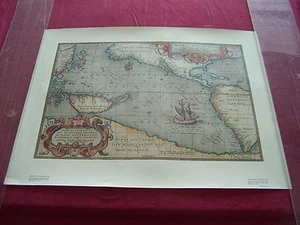
MAP of the PACIFIC OCEAN in 1589-From an engraving of Historic Plans, Ithaca, NY
US $26.95
ApproximatelyRM 110.82
or Best Offer
Was US $29.95 (10% off)
Condition:
“Nothing to declare with this listing. Map is in NEAR MINT condition.”
Oops! Looks like we're having trouble connecting to our server.
Refresh your browser window to try again.
Shipping:
US $22.05 (approx RM 90.67) USPS Priority Mail®.
Located in: Palm Desert, California, United States
Save on combined shipping
Delivery:
Estimated between Tue, 9 Dec and Thu, 11 Dec to 94104
Returns:
No returns accepted.
Coverage:
Read item description or contact seller for details. See all detailsSee all details on coverage
(Not eligible for eBay purchase protection programmes)
About this item
Seller assumes all responsibility for this listing.
eBay item number:226506709077
Item specifics
- Seller Notes
- “Nothing to declare with this listing. Map is in NEAR MINT condition.”
Item description from the seller
Seller feedback (1,366)
- u***i (6)- Feedback left by buyer.Past 6 monthsVerified purchaseThis poster is awesome!! And exactly as described. It’s was packaged carefully with very fast delivery!! This is for my husbands Birthday to add to his collection and he is going to love it! Great price. Thank you, I would highly recommend this seller!1918 KEEP HIM FREE BUY WAR SAVINGS STAMPS WWI Poster -Charles Livingston Bull LL (#226919115736)
- 2***1 (1088)- Feedback left by buyer.Past monthVerified purchaseStunning piece that was sold for a very reasonable price. Fast shipping that was well packed and exactly as described. 5 stars
- 3***s (24)- Feedback left by buyer.Past monthVerified purchasePoster was in excellent condition, as described, and package was received in good condition. Shipping cost was reasonable to protect this high value asset.
More to explore :
- Ocean Current Map Antique Atlas Maps,
- Antique Ocean Current Maps,
- Lithography Antique Ocean Current Maps,
- Antique World Ocean Current Maps,
- World Antique World Ocean Current Maps,
- World Antique Original Antique World Ocean Current Maps,
- Lithography Antique Original Antique World Ocean Current Maps,
- 1800-1899 Date Range Antique World Ocean Current Maps,
- DC, DE, MD, NJ, NY, PA Antique North America Topographical Maps,
- Woodcut DC, DE, MD, NJ, NY, PA Antique North American Maps & Atlases