Picture 1 of 10


Gallery
Picture 1 of 10


Have one to sell?
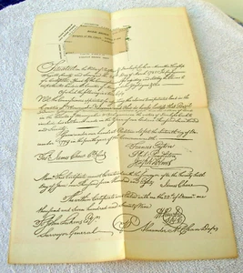
1785 John Lukens MAP of Redstone & Dunlaps Creeks. 1894 Reprint # 18

US $55.00
ApproximatelyRM 232.41
or Best Offer
Condition:
“See Item Description”
Oops! Looks like we're having trouble connecting to our server.
Refresh your browser window to try again.
Shipping:
Free USPS Ground Advantage®.
Located in: Bristol, Pennsylvania, United States
Delivery:
Estimated between Tue, 9 Sep and Mon, 15 Sep to 94104
Returns:
No returns accepted.
Coverage:
Read item description or contact seller for details. See all detailsSee all details on coverage
(Not eligible for eBay purchase protection programmes)
Seller assumes all responsibility for this listing.
eBay item number:226421917448
Item specifics
- Seller Notes
- “See Item Description”
- US State
- Pennsylvania
- Printing Technique
- Lithography
- Date of Creation
- 1894
- Cartographer/Publisher
- Clarence M Busch
- City
- Fayette County
- Printer
- Clarence M Busch
- North America States & Provinces
- Pennsylvania
- Maker
- John Lukens
- Subject
- Monongahela
- Publication Year
- 1784
- Date Range
- 1700-1799
- Type
- Hand Color
- Format
- Folding Map
- Era
- 19th century
- State
- Pennsylvania
- Original/Reproduction
- Vintage Reproduction
- Topic
- Maps
- Country/Region
- United States of America
Item description from the seller

Popular categories from this store
Seller feedback (6,593)
- b***d (1320)- Feedback left by buyer.Past monthVerified purchaseVery quick ship. Arrived in perfect shape. Would highly recommend this seller A+++++.
- p***f (7044)- Feedback left by buyer.Past monthVerified purchaseExcellent seller
- o***t (2699)- Feedback left by buyer.Past monthVerified purchaseReceived today - fantastic photo - thank you very much!!!
More to explore :
- John Bartholomew Political Map Antique Atlas Maps,
- John Cary Antique Atlas Maps,
- John Bartholomew Antique Topographical Maps,
- John Bartholomew Antique Atlas Maps,
- John Bartholomew Antique Political Maps,
- Antique European Maps & Atlases John Cary,
- John Speed Antique Maps, Atlases & Globes,
- John Bartholomew Antique Europe Political Maps,
- John Ogilby Antique Maps, Atlases & Globes,
- John Luffman Antique Maps, Atlases & Globes
Popular categories from this store
Seller feedback (6,593)
- b***d (1320)- Feedback left by buyer.Past monthVerified purchaseVery quick ship. Arrived in perfect shape. Would highly recommend this seller A+++++.
- p***f (7044)- Feedback left by buyer.Past monthVerified purchaseExcellent seller
- o***t (2699)- Feedback left by buyer.Past monthVerified purchaseReceived today - fantastic photo - thank you very much!!!