Picture 1 of 3


Picture 1 of 3


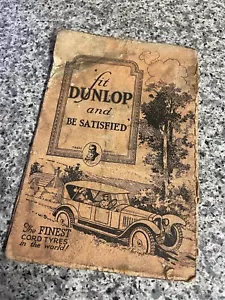
Dunlop Touring Maps Of Great Britain And Ireland No.10 Eastern Counties

GBP 15.00
ApproximatelyRM 83.68
or Best Offer
Condition:
Postage:
GBP 16.54 (approx RM 92.27) International Priority Shipping to United States via eBay's Global Shipping Program.
Located in: Cambridge, United Kingdom
Import charges:
Free amount confirmed at checkout
Delivery:
Estimated between Tue, 1 Oct and Wed, 9 Oct to 43230
Includes international tracking
Returns:
14 days return. Buyer pays for return shipping.
Coverage:
Read item description or contact seller for details. See all detailsSee all details on coverage
(Not eligible for eBay purchase protection programmes)
Seller assumes all responsibility for this listing.
eBay item number:226097911250
Item specifics
- Antique
- Yes
- Type
- County Map
- Format
- Folding Map
- Printing Technique
- Copper Plate
- Original/Reproduction
- Vintage Original
- Cartographer/Publisher
- Dunlop
- Country/Region
- United Kingdom
- County
- Eastern Counties
Item description from the seller

Seller feedback (556)
- e***s (112)- Feedback left by buyer.Past monthVerified purchaseA+
- 7***_ (20)- Feedback left by buyer.Past monthVerified purchaseGreat ,as described
- r***0 (624)- Feedback left by buyer.Past monthVerified purchaseGreat item, fast delivery, very happy with this purchase.
More to explore :
- Ireland Antique Europe County Maps,
- Ireland County Map Antique Europe Atlas Maps,
- Ireland Meath Antique Europe County Maps,
- Ireland Wicklow Antique Europe County Maps,
- Ireland Lithography Antique Europe County Maps,
- Ireland 1800-1899 Date Range Antique Europe County Maps,
- Antique Europe County Maps,
- Ireland Antique Europe Maps & Atlases,
- Antique Asia County Maps,
- Antique North America County Maps