Picture 1 of 18


Gallery
Picture 1 of 18


Have one to sell?
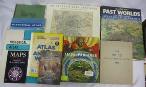
Cartography Historical Maps Map Making 10 Book Lot Atlas Ancient Modern

US $49.97
ApproximatelyRM 212.31
Condition:
“Please read the full description and view the photos.”
Very Good
A book that has been read but is in excellent condition. No obvious damage to the cover, with the dust jacket included for hard covers. No missing or damaged pages, no creases or tears, and no underlining/highlighting of text or writing in the margins. May be very minimal identifying marks on the inside cover. Very minimal wear and tear.
Oops! Looks like we're having trouble connecting to our server.
Refresh your browser window to try again.
Pickup:
Free local pickup from Denver, Colorado, United States.
Shipping:
US $18.72 (approx RM 79.54) USPS Media MailTM.
Located in: Denver, Colorado, United States
Delivery:
Estimated between Mon, 21 Jul and Thu, 24 Jul to 94104
Ships today if you order in the next 1 hr 8 mins
Returns:
30 days return. Buyer pays for return shipping. If you use an eBay shipping label, it will be deducted from your refund amount.
Coverage:
Read item description or contact seller for details. See all detailsSee all details on coverage
(Not eligible for eBay purchase protection programmes)
Seller assumes all responsibility for this listing.
eBay item number:205605213244
Item specifics
- Condition
- Very Good
- Seller Notes
- “Please read the full description and view the photos.”
- ISBN
- 9781780239293
About this product
Product Identifiers
Publisher
Reaktion Books, The Limited
ISBN-10
1780239297
ISBN-13
9781780239293
eBay Product ID (ePID)
239732326
Product Key Features
Book Title
Trading Territories : Mapping the Early Modern World
Number of Pages
208 Pages
Language
English
Topic
Cartography, Historical Geography, General, Expeditions & Discoveries
Publication Year
2019
Illustrator
Yes
Genre
Technology & Engineering, History
Format
Trade Paperback
Dimensions
Item Height
0.9 in
Item Length
7.7 in
Item Width
5 in
Additional Product Features
Intended Audience
Trade
Dewey Edition
21
Reviews
In this outstanding study of maps and mapping, Brotton reveals a dynamism in the transaction between East and West beyond anything we have previously appreciated., A beautifully illustrated account of the status, construction and purposes of maps in the early modern world., Brotton's elegant Trading Territories shows how historically maps were about facilitating trade and celebrating (and exerting) influence., Brotton's Trading Territories is a history not just of how the first truly global maps were made but how they were conceptualized, and how they shaped as well as described the earlymodern world. . . . Trading Territories covers a wide sweep of shifting territory with verve and authority.
Dewey Decimal
912/.09
Synopsis
Trading Territories tells the compelling story of maps and geographical knowledge in the early modern world from the fifteenth to the early seventeenth century. Examining how European geographers mapped the territories of the Old World--Africa and Southeast Asia--this book shows how the historical preoccupation with Columbus's "discovery" of the New World of America in 1492 obscured the ongoing importance of mapping territories that have since been defined as "Eastern," especially those in the Muslim world. In this book, now available in its second edition and updated with a new preface by the author, Jerry Brotton shows that trade and diplomacy defined the development of maps and globes in this period, far more than the disinterested pursuit of scientific accuracy and objectivity, and challenges our preconceptions about not just maps, but also the history and geography of what we call East and West., Trading Territories tells the compelling story of maps and geographical knowledge in the early modern world from the fifteenth to the early seventeenth century. Examining how European geographers mapped the territories of the Old World - Africa and Southeast Asia - this book shows how the historical preoccupation with Columbus's 'discovery' of the New World of America in 1492 obscured the ongoing importance of mapping territories that have since been defined as 'eastern', especially those in the Muslim world. In this book, now available in paperback and updated with a new preface by the author, Jerry Brotton shows that trade and diplomacy defined the development of maps and globes in this period, far more than the disinterested pursuit of scientific accuracy and objectivity, and challenges our preconceptions about not just maps, but also the history and geography of what we call East and West.
LC Classification Number
GA201
Item description from the seller

Seller feedback (10,174)
- 5***5 (917)- Feedback left by buyer.Past monthVerified purchaseGreat item. Condition as described and pictured. Fast shipping. Secure packaging.
- e***s (1129)- Feedback left by buyer.Past monthVerified purchaseWell packed, Super fast shipment! Thank you!
- a***f (2002)- Feedback left by buyer.Past monthVerified purchaseVery happy with the book, thanks for the fast ship too! My son is going to love it!
More to explore :
- Atlas Paperback Maps & Atlases in English,
- Folding Maps Books,
- Folding Maps Books in German,
- Michelin Folding Maps Books,
- Folding Maps Books in English,
- Ancient Literature & Fiction Books Modernism Fiction,
- Michelin Folding Map Maps & Atlases,
- Geological Maps,
- Ancient Antiquarian & Collectible Books,
- Ancient Greek Fiction & Books
Seller feedback (10,174)
- 5***5 (917)- Feedback left by buyer.Past monthVerified purchaseGreat item. Condition as described and pictured. Fast shipping. Secure packaging.
- e***s (1129)- Feedback left by buyer.Past monthVerified purchaseWell packed, Super fast shipment! Thank you!
- a***f (2002)- Feedback left by buyer.Past monthVerified purchaseVery happy with the book, thanks for the fast ship too! My son is going to love it!