Picture 1 of 14


Gallery
Picture 1 of 14


Have one to sell?
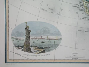
1898 rare ORIGINAL MAP UNITED STATES MEXICO TEXAS CALIFORNIA FLORIDA CANADA CUBA
US $64.49
ApproximatelyRM 275.90
or Best Offer
Condition:
“SOME STAINS, SOME SCATTERED SPOTTING AND FOXING //// I INVITE YOU TO MY SHOP //////”
Oops! Looks like we're having trouble connecting to our server.
Refresh your browser window to try again.
Shipping:
US $16.00 (approx RM 68.45) Economy Shipping from outside US.
Located in: Zary, Poland
Delivery:
Estimated between Fri, 8 Aug and Fri, 22 Aug to 94104
Returns:
No returns accepted.
Coverage:
Read item description or contact seller for details. See all detailsSee all details on coverage
(Not eligible for eBay purchase protection programmes)
Shop with confidence
Seller assumes all responsibility for this listing.
eBay item number:205387719801
Item specifics
- Seller Notes
- “SOME STAINS, SOME SCATTERED SPOTTING AND FOXING //// I INVITE YOU TO MY SHOP //////”
- Printing Technique
- Copper Plate
- US State
- AK, HI, AL, FL, GA, MS, NC, SC, AR, IA, KS, LA, MO, NE, AZ, CA, CO, NM, NV, UT, Alabama, Alaska, Arizona, Arkansas, California, Colorado, Connecticut, Florida, Georgia, Illinois, Indiana, Iowa, Louisiana, Massachusetts, Michigan, Mississippi, New Mexico, New York, Oklahoma, Oregon, Pennsylvania, South Carolina, Texas, Virginia, Washington, West Virginia
- Cartographer/Publisher
- Lacoste / Migeon / Vuillemin
- City
- Dallas Houston Los Angeles Washington Toronto Atlanta Tampa
- Date Range
- 1700-1799
- Continent
- North America
- Type
- Political Map
- Mexican State
- Aguascalientes, Baja California, Baja California Sur, Campeche, Chiapas, Chihuahua, Coahuila, Colima, Durango, Guanajuato, Guerrero, Hidalgo, Jalisco, Michoacán, Morelos, Nuevo León, Oaxaca, Puebla, Querétaro, Quintana Roo, San Luis Potosí, Sinaloa, Sonora, Tabasco, Tamaulipas, Tlaxcala, Veracruz, Yucatán, Zacatecas
- Format
- Atlas Map
- Canadian Province
- Alberta, British Columbia, Manitoba, New Brunswick, Newfoundland & Labrador, Northwest Territories, Nova Scotia, Nunavut, Ontario, Prince Edward Island, Quebec, Saskatchewan
- Year
- 1898
- Original/Reproduction
- Antique Original
- Topic
- Maps
- Country/Region
- United States
Item description from the seller
Seller feedback (1,156)
- v***i (295)- Feedback left by buyer.Past monthVerified purchaseExcellent international transaction. A+++ Thanks!
- m***b (1099)- Feedback left by buyer.Past monthVerified purchaseReally nice map of antiquity. Purchased as a gift for friends. Shipping took over a month which was slightly painful.
- s***r (21)- Feedback left by buyer.Past monthVerified purchaseThank you!
More to explore :
- Mexico Texas Antique Original Antique North American Maps & Atlases,
- Mexico California Antique Original Antique North American Maps & Atlases,
- United States of America Texas Antique Original Antique North American Maps & Atlases,
- United States of America California Vintage Original Antique North American Maps & Atlases,
- Mexico Baja California Antique Original Antique North American Maps & Atlases,
- United States of America Florida Antique North America Maps & Atlases,
- United States of America Texas Antique North America County Maps,
- United States of America California Antique North America Nautical Maps,
- United States of America California Antique North America Topographical Maps,
- United States of America New Mexico Antique North America Topographical Maps