Picture 1 of 1
Gallery
Picture 1 of 1

Have one to sell?
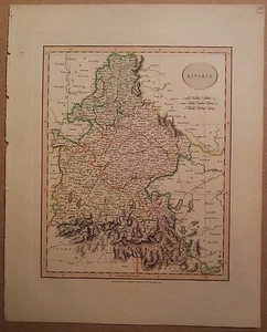
JOHN CARY MAP OF BAVARIA 1813 FROM HIS New Elementary Atlas
GBP 65.00
ApproximatelyRM 371.18
or Best Offer
Condition:
Oops! Looks like we're having trouble connecting to our server.
Refresh your browser window to try again.
Shipping:
GBP 10.25 (approx RM 58.53) Royal Mail International Signed.
Located in: Diss, United Kingdom
Delivery:
Estimated between Mon, 18 Aug and Mon, 25 Aug to 94104
Returns:
No returns accepted.
Coverage:
Read item description or contact seller for details. See all detailsSee all details on coverage
(Not eligible for eBay purchase protection programmes)
Seller assumes all responsibility for this listing.
eBay item number:202649913390
Item specifics
- Antique/ Modern
- Antique
- Map Type
- Historical/ Political
Item description from the seller
Seller feedback (19,575)
- l***a (210)- Feedback left by buyer.Past monthVerified purchaseFantastic seller and bracelet, exactly as described. Thank you so much!!! A+++++
- 7***4 (210)- Feedback left by buyer.Past monthVerified purchaseAWESOME!!.............Thank you
- a***_ (966)- Feedback left by buyer.Past monthVerified purchaseThank you.
More to explore :
- John Cary Antique Atlas Maps,
- John Cary Antique Europe Atlas Maps,
- Bavaria Antique Europe Atlas Maps,
- Germany Bavaria Antique Europe Atlas Maps,
- Lithography Bavaria Antique Europe Atlas Maps,
- John Cary Antique Maps, Atlases & Globes,
- John Bartholomew Topographical Map Antique North America Atlas Maps,
- John Bartholomew Antique North America Atlas Maps,
- New York County Map Antique North America Atlas Maps,
- Antique Atlas Maps