Picture 1 of 6


Gallery
Picture 1 of 6


Have one to sell?
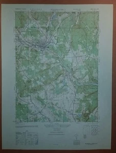
1940's Army topographic map Williamantic Connecticut -Sheet 6567 II NW

US $24.99
ApproximatelyRM 106.04
or Best Offer
Condition:
“This map is near perfect, no yellowing, stains, tears or marks.”
Oops! Looks like we're having trouble connecting to our server.
Refresh your browser window to try again.
Shipping:
US $4.50 (approx RM 19.09) USPS First Class®.
Located in: Slingerlands, New York, United States
Delivery:
Estimated between Thu, 31 Jul and Thu, 7 Aug to 94104
Returns:
30 days return. Buyer pays for return shipping. If you use an eBay shipping label, it will be deducted from your refund amount.
Coverage:
Read item description or contact seller for details. See all detailsSee all details on coverage
(Not eligible for eBay purchase protection programmes)
Seller assumes all responsibility for this listing.
eBay item number:202634242388
Item specifics
- Seller Notes
- “This map is near perfect, no yellowing, stains, tears or marks.”
Item description from the seller

Popular categories from this store
Seller feedback (892)
- j***i (1202)- Feedback left by buyer.Past monthVerified purchaseLove the map, thanks.
- o***b (217)- Feedback left by buyer.Past monthVerified purchasePerfect transaction, thank you.
- h***p (494)- Feedback left by buyer.Past monthVerified purchaseJust as pictured
More to explore :
- Connecticut Topographical Map Antique North America Sheet Maps,
- Connecticut 1940-1949 Date Range Antique North America Topographical Maps,
- Connecticut Antique North America Topographical Maps,
- Topographical Map Antique Sheet Maps,
- 1940-1949 Date Range Sheet Map Topographical Map Antique Maps, Atlases & Globes,
- 1940-1949 Date Range Topographical Map Antique North America Sheet Maps,
- Colorado Topographical Map Antique North America Sheet Maps,
- Illinois Topographical Map Antique North America Sheet Maps,
- Massachusetts Topographical Map Antique North America Sheet Maps,
- Maine Topographical Map Antique North America Sheet Maps
Popular categories from this store
Seller feedback (892)
- j***i (1202)- Feedback left by buyer.Past monthVerified purchaseLove the map, thanks.
- o***b (217)- Feedback left by buyer.Past monthVerified purchasePerfect transaction, thank you.
- h***p (494)- Feedback left by buyer.Past monthVerified purchaseJust as pictured