Picture 1 of 3


Gallery
Picture 1 of 3


Have one to sell?
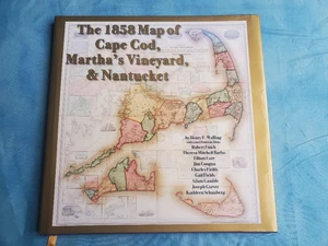
The 1858 Map of Cape Cod, Martha's Vineyard, & Nantucket HCDJ
US $15.99
ApproximatelyRM 66.89
or Best Offer
Condition:
“Near fine in jacket. Tight square and clean. Pre-owned”
Oops! Looks like we're having trouble connecting to our server.
Refresh your browser window to try again.
Shipping:
US $5.97 (approx RM 24.97) USPS Media MailTM.
Located in: Centerville, Massachusetts, United States
Delivery:
Estimated between Wed, 12 Nov and Tue, 18 Nov to 94104
Returns:
30 days return. Buyer pays for return shipping. If you use an eBay shipping label, it will be deducted from your refund amount.
Coverage:
Read item description or contact seller for details. See all detailsSee all details on coverage
(Not eligible for eBay purchase protection programmes)
Seller assumes all responsibility for this listing.
eBay item number:197738403646
Item specifics
- Condition
- Very Good
- Seller Notes
- “Near fine in jacket. Tight square and clean. Pre-owned”
- Release Year
- 2009
- Original Language
- English
- ISBN
- 9780978576677
About this product
Product Identifiers
Publisher
On Cape Publications
ISBN-10
0978576675
ISBN-13
9780978576677
eBay Product ID (ePID)
78486176
Product Key Features
Book Title
1858 Map of Cape Cod, Martha's Vineyard, and Nantucket
Number of Pages
132 Pages
Language
English
Topic
Maps & Road Atlases (See Also Reference / Atlases, Gazetteers & Maps), Americas (North, Central, South, West Indies), United States / General
Publication Year
2009
Illustrator
Walling, Henry F., Yes
Genre
Travel, History
Format
Trade Paperback
Dimensions
Item Height
0.7 in
Item Weight
53.7 Oz
Item Length
12.5 in
Item Width
12.5 in
Additional Product Features
Intended Audience
Trade
Preface by
Garver, Joseph
TitleLeading
The
Item description from the seller
Popular categories from this store
Seller feedback (3,821)
- s***i (73)- Feedback left by buyer.Past 6 monthsVerified purchaseThe packaging and value were great! Books exactly as described, everything in almost mint condition! Shipping was okay, 20 days for international shipping
- t***d (650)- Feedback left by buyer.Past monthVerified purchasePackage arrived quickly and well packaged. As described. Great communication. Bid with confidence.
- y***4 (198)- Feedback left by buyer.Past 6 monthsVerified purchaseShipping was super fast, and the book was well protected with the packaging. The book matched the description exactly. Would definitely buy from this seller again.
More to explore :
- Martha Stewart Fiction & Books,
- Martha Stewart Living Magazines,
- Martha Stewart Nonfiction Books Fiction & Cookbooks,
- Martha Stewart Hardcover Books,
- Martha Stewart Living Children Magazines,
- Folding Map Maps & Atlases,
- Martha Stewart Nonfiction Fiction & Books,
- Martha Stewart Fiction Fiction & Books,
- Martha Stewart Living Cooking Magazines,
- Martha Stewart Living Fashion Magazines