Picture 1 of 8


Gallery
Picture 1 of 8


Have one to sell?
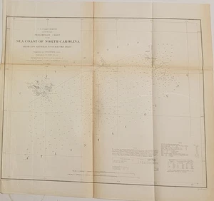
1856 US Coast Survey nautical chart sea coast Pamplico North Carolina Bache
US $35.00
ApproximatelyRM 144.80
Condition:
“Folding B&W chart in fair antique condition, light age toning, darker along the folds a fold ”... Read moreabout condition
Oops! Looks like we're having trouble connecting to our server.
Refresh your browser window to try again.
Shipping:
Free USPS Ground Advantage®.
Located in: Lafayette, Colorado, United States
Delivery:
Estimated between Tue, 2 Dec and Sat, 6 Dec to 94104
Returns:
No returns accepted.
Coverage:
Read item description or contact seller for details. See all detailsSee all details on coverage
(Not eligible for eBay purchase protection programmes)
About this item
Seller assumes all responsibility for this listing.
eBay item number:197609544641
Item specifics
- Seller Notes
- Country of Origin
- United States
- Date Range
- 1800-1899
- Type
- Nautical Map
- Format
- Folding Map
- Printing Technique
- Lithography
- US State
- North Carolina
- Year
- 1856
- Original/Reproduction
- Antique Original
- Cartographer/Publisher
- A. D. Bache
- City
- Portsmouth, Cape Hatteras, Pamplico Sound
- Country/Region
- United States of America
Item description from the seller
Seller feedback (120)
- e***v (2189)- Feedback left by buyer.Past 6 monthsVerified purchaseItem as described. Packaged well, shipped quickly. Great seller.
- 0***0 (221)- Feedback left by buyer.Past monthVerified purchaseQuick shipping and great packaging. Great value here! A+++seller
- b***0 (595)- Feedback left by buyer.Past 6 monthsVerified purchaseAccurate description as well as fast and safe arrival of item; great seller.
More to explore :
- US Coast Guard Antique Maritime Navigational Charts,
- US Coast Guard Maritime Antiques,
- US Coast Guard Antique Maritime Clocks,
- US Coast Guard Antique Model Ships,
- US Coast Guard Antique Maritime Compasses,
- US Coast Guard Vintage Reproduction Maritime Antiques,
- North Carolina Antique North America Maps & Atlases,
- North Carolina Antique North America Topographical Maps,
- Baltimore North Carolina Antique North America Maps & Atlases,
- Michigan Antique North America Nautical Maps