
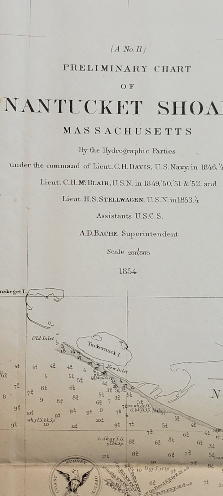
Two 1854 US Coast Survey chart map 12 & 13 Nantucket Shoals, Massachusetts
US $75.00US $75.00
Jul 29, 22:33Jul 29, 22:33
Picture 1 of 19


Gallery
Picture 1 of 19


Have one to sell?
Two 1854 US Coast Survey chart map 12 & 13 Nantucket Shoals, Massachusetts
US $75.00
ApproximatelyRM 318.38
Best offer accepted
or Best Offer
Condition:
“#12 Folding B&W chart in very good antique condition, printed on sturdy, mildly age-toned paper, ”... Read moreabout condition
Oops! Looks like we're having trouble connecting to our server.
Refresh your browser window to try again.
Shipping:
Free USPS Media MailTM.
Located in: Lafayette, Colorado, United States
Delivery:
Estimated between Thu, 14 Aug and Tue, 19 Aug to 94104
Returns:
No returns accepted.
Coverage:
Read item description or contact seller for details. See all detailsSee all details on coverage
(Not eligible for eBay purchase protection programmes)
Seller assumes all responsibility for this listing.
eBay item number:197570940542
Item specifics
- Seller Notes
- Date Range
- 1800-1899
- Type
- Nautical Chart
- Format
- Folding Map
- Printing Technique
- Lithography
- US State
- Massachusetts
- Year
- 1854
- Original/Reproduction
- Antique Original
- Cartographer/Publisher
- A. D. Bache
- City
- Nantucket
- Country/Region
- United States of America
- Country/Region of Manufacture
- United States
Item description from the seller
Seller feedback (73)
- l***e (60)- Feedback left by buyer.Past monthVerified purchaseLove it. Item as described, well packaged and fast shipping
- p***p (364)- Feedback left by buyer.Past monthVerified purchaseAs advertised!
- h***r (8201)- Feedback left by buyer.Past monthVerified purchaseSmooth fast 5-star T/A *****
More to explore :
- Antique Ordnance Survey Maps,
- Antique Europe Ordnance Survey Maps,
- US Coast Guard Antique Maritime Navigational Charts,
- Vintage Original Antique Ordnance Survey Maps,
- Antique Original Antique Ordnance Survey Maps,
- Massachusetts Topographical Map Antique North America Sheet Maps,
- Massachusetts Antique North America Nautical Maps,
- Massachusetts Antique North America City Maps,
- 1800-1899 Date Range Antique Ordnance Survey Maps,
- Norfolk Massachusetts Antique North American Maps & Atlases