Picture 1 of 23


Gallery
Picture 1 of 23


Have one to sell?
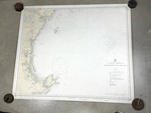
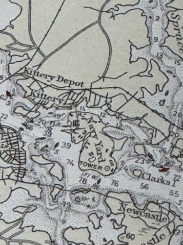
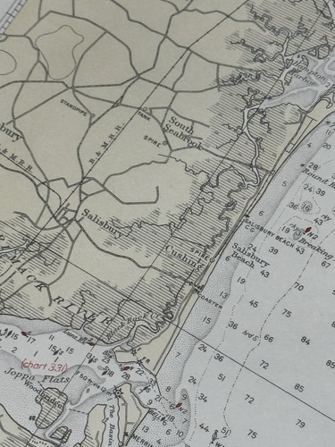
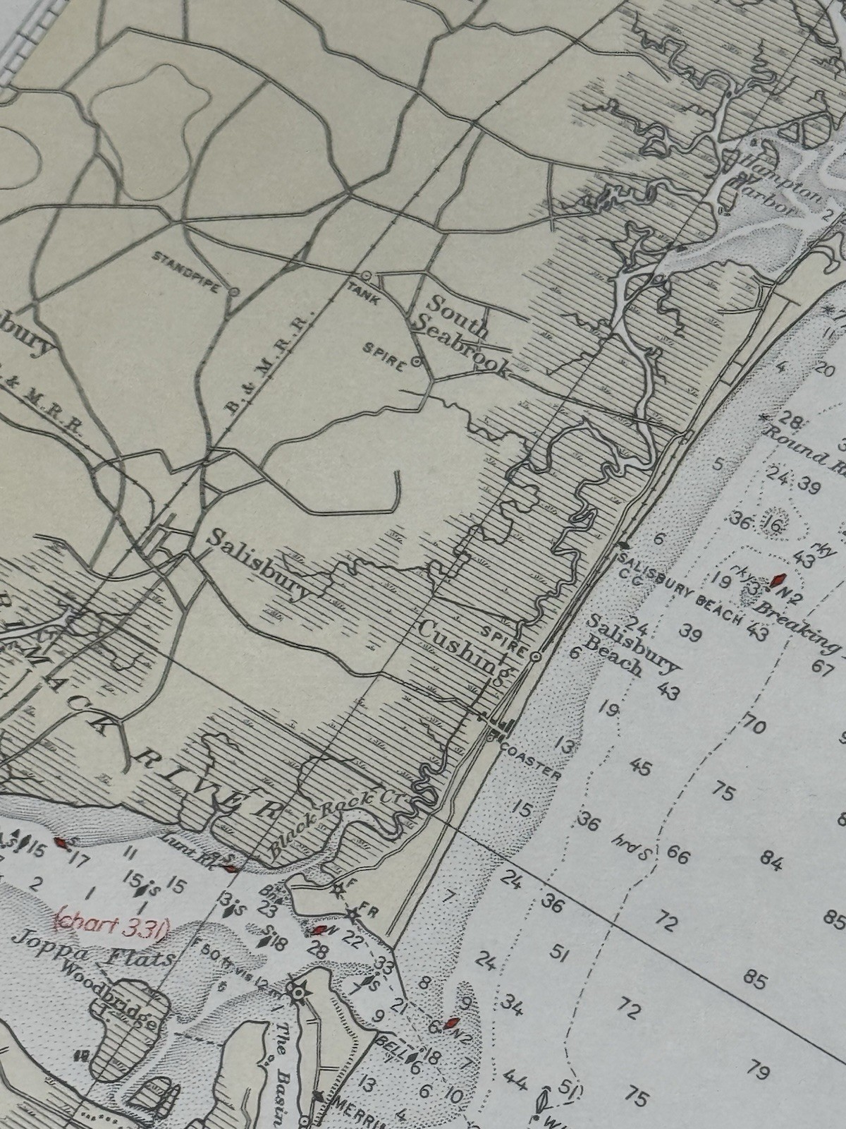
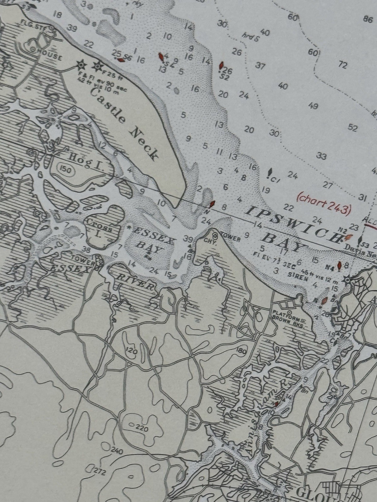
1930 Nautical Chart PORTSMOUTH to CAPE ANN 40" x 34.5" U.S.C & Geodetic Survey

US $59.99
ApproximatelyRM 253.82
Condition:
“nice overall condition, border has a few light stains and/or some holes, photos will show condition”
Oops! Looks like we're having trouble connecting to our server.
Refresh your browser window to try again.
Shipping:
US $9.70 (approx RM 41.04) UPS Ground Saver.
Located in: Saco, Maine, United States
Delivery:
Estimated between Wed, 10 Sep and Tue, 16 Sep to 94104
Returns:
No returns accepted.
Coverage:
Read item description or contact seller for details. See all detailsSee all details on coverage
(Not eligible for eBay purchase protection programmes)
Seller assumes all responsibility for this listing.
eBay item number:197560000272
Item specifics
- Seller Notes
- “nice overall condition, border has a few light stains and/or some holes, photos will show condition”
- Country/Region of Origin
- United States
- Original/Reproduction
- Vintage Original
- Maker
- U.S. Coast & Geodetic Survey
Item description from the seller

Seller feedback (5,835)
- b***h (2099)- Feedback left by buyer.Past monthVerified purchaseExcellent
- b***h (2099)- Feedback left by buyer.Past monthVerified purchaseExcellent
- l***l (1629)- Feedback left by buyer.Past monthVerified purchaseExcellent transaction in all respects. Fast shipping. No problems.
More to explore :
- 1930-1939 Date Range Antique Nautical Maps,
- Antique Ordnance Survey Maps,
- Contemporary 1930-1939 Date Range Antique Nautical Maps,
- Antique Europe Ordnance Survey Maps,
- 1930-1939 Date Range Antique North America Nautical Maps,
- Antique Maritime Navigational Charts,
- 1930s Chandeliers,
- Nautical Antique Furniture,
- Queen Anne Antique Chairs,
- US Navy Antique Maritime Navigational Charts
Seller feedback (5,835)
- b***h (2099)- Feedback left by buyer.Past monthVerified purchaseExcellent
- b***h (2099)- Feedback left by buyer.Past monthVerified purchaseExcellent
- l***l (1629)- Feedback left by buyer.Past monthVerified purchaseExcellent transaction in all respects. Fast shipping. No problems.