Picture 1 of 1
Gallery
Picture 1 of 1

Have one to sell?
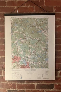
1946 Reading, Massachusetts - USGS Topographic Map - Wakefield Andover Middlesex
US $39.99
ApproximatelyRM 168.21
or Best Offer
Condition:
“Decommissioned museum piece. Please read description for additional information.”
Oops! Looks like we're having trouble connecting to our server.
Refresh your browser window to try again.
Shipping:
US $16.11 (approx RM 67.76) USPS Priority Mail®.
Located in: Rochester, New York, United States
Delivery:
Estimated between Tue, 19 Aug and Tue, 26 Aug to 94104
Returns:
No returns accepted.
Coverage:
Read item description or contact seller for details. See all detailsSee all details on coverage
(Not eligible for eBay purchase protection programmes)
Seller assumes all responsibility for this listing.
eBay item number:195654023713
Item specifics
- Seller Notes
- “Decommissioned museum piece. Please read description for additional information.”
- Date Range
- 1940-1949
- Type
- Topographical Map
- US State
- Massachusetts
- Format
- Sheet Map
- Year
- 1946
- Original/Reproduction
- Vintage Original
- Cartographer/Publisher
- United States Geological Survey (USGS)
- City
- Reading, Massachusetts
- Country/Region
- United States of America
Item description from the seller
Seller feedback (11)
- s***b (1299)- Feedback left by buyer.Past 6 monthsVerified purchasearrived as advertised, great seller
- eBay automated feedback- Feedback left by buyer.Past 6 monthsThis seller successfully completed an order.1935 Romance Map of New Jersey - Mildred Green, Pictorial Original w/ Metal End (#197024032819)
- eBay automated feedback- Feedback left by buyer.Past 6 monthsThis seller successfully completed an order.1936 Hysterical Map of Yellowstone Park - Lindgren Pictorial National Original (#196992007637)
More to explore :
- Massachusetts Antique North America Topographical Maps,
- Massachusetts Topographical Map Antique North America Sheet Maps,
- Massachusetts Topographical Map Antique North America Atlas Maps,
- Massachusetts Topographical Map Antique North America Folding Maps,
- Boston Massachusetts Antique North America Topographical Maps,
- Massachusetts 1800-1899 Date Range Antique North America Topographical Maps,
- Antique European Maps & Atlases England Middlesex,
- Topographical Map Antique Wall Maps,
- Antique Africa Topographical Maps,
- Antique Asia Topographical Maps