Picture 1 of 17


Gallery
Picture 1 of 17


Have one to sell?
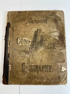
Antique Monteith Comprehensive Geography 1872 Map Drawing and Relief Maps

US $55.00
ApproximatelyRM 231.41
or Best Offer
Condition:
Oops! Looks like we're having trouble connecting to our server.
Refresh your browser window to try again.
Pickup:
Free local pickup from Greencastle, Indiana, United States.
Shipping:
US $5.22 (approx RM 21.96) USPS Media MailTM.
Located in: Greencastle, Indiana, United States
Delivery:
Estimated between Sat, 30 Aug and Sat, 6 Sep to 94104
Returns:
30 days return. Seller pays for return shipping.
Coverage:
Read item description or contact seller for details. See all detailsSee all details on coverage
(Not eligible for eBay purchase protection programmes)
Seller assumes all responsibility for this listing.
eBay item number:186925866075

All net proceeds will support Humane Society of Putnam County Inc.
- Official eBay for Charity listing. Learn more
- This sale benefits a verified non-profit partner.
Item specifics
- Date Range
- 1800-1899
- Printing Technique
- Lithography
- Year
- 1876
- Map View
- World
- Original/Reproduction
- Antique Original
- Cartographer/Publisher
- A.S. Barnes & Company
Item description from the seller

Seller feedback (760)
- i***u (321)- Feedback left by buyer.Past monthVerified purchasesuper great product in excellent condition, thank you
- 1***1 (1452)- Feedback left by buyer.Past monthVerified purchaseThis was a 5-Star transaction all the way around. This Seller deserves high praise, and I highly recommend.
- f***f (331)- Feedback left by buyer.Past monthVerified purchaseGreat seller to work with
More to explore :
- County Map Antique Sheet Maps,
- Topographical Map Antique Wall Maps,
- Physical Map Antique Sheet Maps,
- Geological Map Antique Wall Maps,
- Railroad Map Antique Atlas Maps,
- Topographical Map Antique Atlas Maps,
- Nautical Map Antique Atlas Maps,
- City Map Antique Atlas Maps,
- City Map Antique Wall Maps,
- Political Map Antique School Maps
Seller feedback (760)
- i***u (321)- Feedback left by buyer.Past monthVerified purchasesuper great product in excellent condition, thank you
- 1***1 (1452)- Feedback left by buyer.Past monthVerified purchaseThis was a 5-Star transaction all the way around. This Seller deserves high praise, and I highly recommend.
- f***f (331)- Feedback left by buyer.Past monthVerified purchaseGreat seller to work with