Picture 1 of 6


Gallery
Picture 1 of 6


Have one to sell?
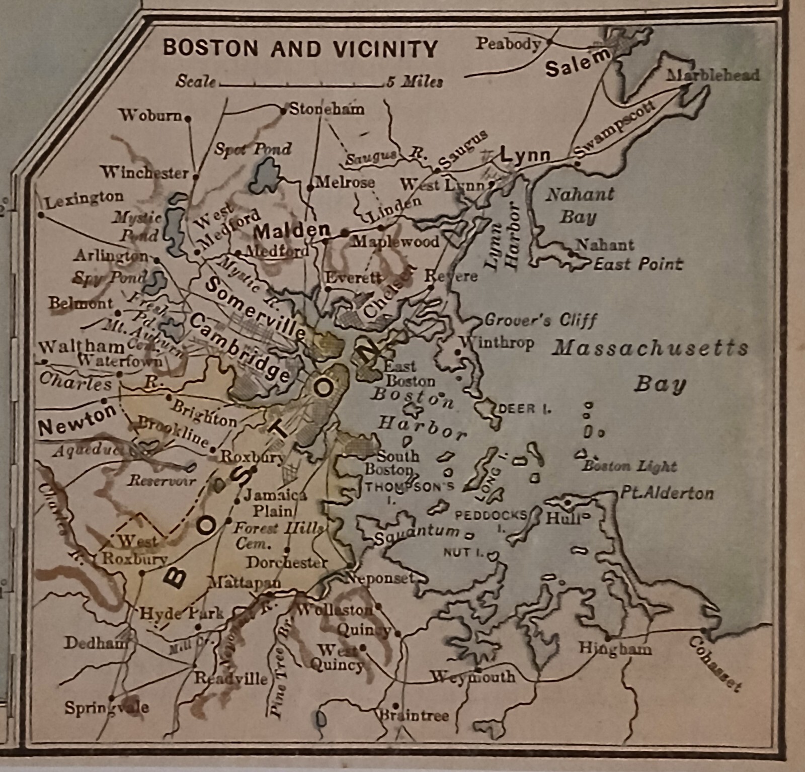
Antique Pre WWI 1912 Map Of The New England States
US $16.99
ApproximatelyRM 72.12
or Best Offer
Condition:
Oops! Looks like we're having trouble connecting to our server.
Refresh your browser window to try again.
Shipping:
US $3.28 (approx RM 13.92) USPS First Class Large Envelope.
Located in: Columbia, Pennsylvania, United States
Delivery:
Estimated between Thu, 14 Aug and Wed, 20 Aug to 94104
Returns:
No returns accepted.
Coverage:
Read item description or contact seller for details. See all detailsSee all details on coverage
(Not eligible for eBay purchase protection programmes)
Seller assumes all responsibility for this listing.
eBay item number:176821687372
Item specifics
- Date Range
- 1910-1919
- Type
- Political Map
- US State
- New Hampshire, Rhode Island, Vermont, Massachusetts, Maine, CT, MA, ME, NH, RI, VT, Connecticut
- Format
- Atlas Map
- Year
- 1912
- Original/Reproduction
- Antique Original
- Cartographer/Publisher
- M. F. Maury
- City
- Boston
- Country/Region
- United States of America
Item description from the seller
Seller feedback (209)
- d***d (648)- Feedback left by buyer.Past monthVerified purchaseVery nice bowl. Well wrapped for shipping and arrived on time. Seller was easy to work with.
- 9***- (50)- Feedback left by buyer.Past monthVerified purchaseBeautiful piece as described, packed well and shipped quickly! Thank you!
- b***u (5729)- Feedback left by buyer.Past monthVerified purchaseRECOMMEND TO ALL
More to explore :
- United States WWI Maritime Antiques,
- England Antique Europe Maps & Atlases,
- England Antique Europe Sheet Maps,
- England Antique Europe County Maps,
- England Antique Europe Folding Maps,
- England Antique Europe Railroad Maps,
- England County Map Antique Europe Atlas Maps,
- London England Antique Europe Folding Maps,
- United States WWI Antique Maritime Telescopes,
- Antique European Maps & Atlases England Cheshire