Picture 1 of 1
Gallery
Picture 1 of 1

Have one to sell?
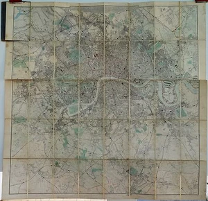
Antique maps, Davies's new map of the British Metropolis, 1886

GBP 350.00
ApproximatelyRM 1,985.73
or Best Offer
Condition:
Oops! Looks like we're having trouble connecting to our server.
Refresh your browser window to try again.
Shipping:
GBP 16.00 (approx RM 90.78) Royal Mail International Tracked.
Located in: Chichester, United Kingdom
Delivery:
Estimated between Thu, 31 Jul and Thu, 7 Aug to 94104
Returns:
30 days return. Buyer pays for return shipping. If you use an eBay shipping label, it will be deducted from your refund amount.
Coverage:
Read item description or contact seller for details. See all detailsSee all details on coverage
(Not eligible for eBay purchase protection programmes)
Seller assumes all responsibility for this listing.
eBay item number:176466277455
Item specifics
- Map Type
- Sea Chart
- Format
- Sheet Map
- Colouring
- Black & White
- Original/Repro
- Original
- Age
- Pre-1800
Item description from the seller

Seller feedback (703)
- a***z (3176)- Feedback left by buyer.Past monthVerified purchaseVery nice map. Seller could have packed the item a bit more securely but it arrived in good shape. Great eBayer!
- 8***t (433)- Feedback left by buyer.Past monthVerified purchaseReceived as described
- eBay automated feedback- Feedback left by buyer.Past monthOrder completed successfully—tracked and on time
More to explore :
- New York Topographical Map Antique North America Folding Maps,
- New York County Map Antique North America Folding Maps,
- New York Railroad Map Antique North America Sheet Maps,
- New York City Map Antique North America Atlas Maps,
- New York Geological Map Antique North America Folding Maps,
- New York Topographical Map Antique North America Sheet Maps,
- New Mexico Topographical Map Antique North America Sheet Maps,
- County Map Antique Sheet Maps,
- Topographical Map Antique Sheet Maps,
- County Map Antique Folding Maps
Seller feedback (703)
- a***z (3176)- Feedback left by buyer.Past monthVerified purchaseVery nice map. Seller could have packed the item a bit more securely but it arrived in good shape. Great eBayer!
- 8***t (433)- Feedback left by buyer.Past monthVerified purchaseReceived as described
- eBay automated feedback- Feedback left by buyer.Past monthOrder completed successfully—tracked and on time